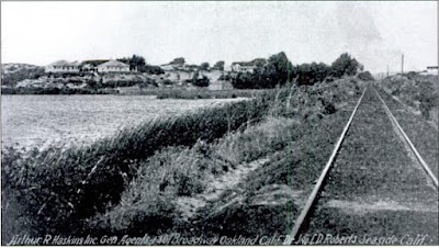
Friday, July 31, 2015

Del Monte

The Hotel Del Monte, like so many other large resort complexes built in California in the 1870s and 1880s, was the product of the Big Four. Charles Crocker erected the hotel in 1880 on 20,000 acres of railroad land just to the southeast of the Monterey pier. It was designed from its first day as a railroad stop and the Southern Pacific Railroad erected that stop nearby with carriage service running to the hotel for each and every train. Indeed, it was via the railroad that most guests came to the hotel and it was via railroad advertising such as Sunset Magazine that people knew about the hotel. The main building of the hotel was a luxurious structure built by SP-architect Arthur Brown, Sr., and done in the Tudor-style with a tall tower and Alpine entry building. Its gardens and grounds reached all the way to Carmel, 8.5 miles away, and included a golf course that would later become Pebble Beach, a race track, a polo field, and a scenic seventeen-mile road through it all. The original structure, shown in the stereoscopic photograph below, burned down in 1887.

The original Hotel Del Monte in Tudor-style, c. 1885.
The second hotel opened in 1889 and replicated the style of the first. It was this rendition that became the most well known. To accompany the new structure, a large bath house was built at the beach, and other facilities were expanded as well. In 1906, the San Francisco Earthquake damaged parts of the hotel, killing two people, but repairs were made and the hotel soon reopened. The hotel became world-renowned, with its own dedicated scheduled train, the Del Monte Express (originally the Del Monte Limited), cruising into the property daily. A small food distributor in Oakland was hired to make special products just for the hotel, a company that would one day be named Del Monte Foods.

An advertisement for the 2nd Hotel Del Monte, c. 1890. (Brancroft Library)
The Southern Pacific sold the hotel and its vast properties in 1919 to Samuel Finley Brown Morse, who ran it as a private hotel. Morse immediately began erection of a new Roman-style freshwater pool near the hotel and added eight other structures to the property. Disaster struck the hotel again in 1924 when it burned to the ground. Many of the detached structures survived and the hotel itself reopened two years later with architects Lewis P. Hobart and Clarence A. Tantau designing the new structure. The architects chose not to return to the Tudor style of before but adopt the Spanish-revival style that was popular at the time. This is the version of the hotel that still stands today.

Del Monte Station, April 1940. (Wilbur C. Whittaker)
Details of the original track-side station are scarce, but the new structure built for the 1926 hotel exists in photographs. The station was located on the north side of Del Monte Avenue across the road from the hotel grounds. It was composed entirely of an open-air passenger shelter with elaborate Spanish arches all around it and a terra cotta tile roof. A double-track passed beside the station on the north side and the 1913 USGS map shows at least one spur and two additional sidings beside the station. Two more short spurs broke off just to the west of the station, with on heading into the hotel grounds for a short distance. By at least the 1920s, the station was within the yard limits for Monterey Station, which was slightly to the west, but it does not seem to have been within those limits in 1913. Over time, the number of sidings and spurs was reduced until only one siding remained, as is barely visible in the photograph below. The Del Monte Express became just the plain-old "Del Monte" in 1927 and once the navy took over the hotel in 1941, the special train hardly even catered to the hotel anymore, despite its name. The navy did not need the stop in the same manner the hotel did and, although it remained on timetables until the reduction of the line to Seaside in 1978, few passengers seemed to use the station and it was reduced to a flag-stop in the mid-1950s, a sorry fate for a station that helped finance and justify the entire Monterey Branch for so long.

A Del Monte excursion train parked beside the depot in 1949. (Wilbur C. Whittaker)
The United States Navy leased the hotel at the start of World War II and it would never again be used as a public hotel. In 1947, the government purchased it outright, including most of the surrounding lands, and established the United States Naval Academy's postgraduate academy there in 1951. The main hotel structure was renamed Hermann Hall and all of the other buildings have either been converted into houses or offices or been demolished.

Official Railroad Information:
The second Hotel Del Monte, c. 1920. (Bancroft Library)
Del Monte appeared on Southern Pacific documents from 1880 onwards. It was located 124.9 miles from San Francisco via Castroville, Gilroy, and San José, and was 5.1 miles from the Lake Majella end-of-track. The station never had a platform and was, therefore, usually designated as a low-class freight station, although freight cars do appear to have stopped there at times, perhaps for catering or construction purposes. By the late 1920s, the station was included within the yard limits of Monterey and was recorded as having 119 carlengths (5,950 feet) of trackage, although this undoubtedly included trackage located elsewhere along the yard. A note in a 1930 station book states that the station included a private siding owned by S. Ruthven, but no further details on this are presently known. The station remained on timetables until the branch was shortened in 1978, but regular passenger service to Del Monte ended in April 1971 when the Del Monte train ran for the last time.

Geo-Coordinates & Access Rights:
The third Hotel Del Monte, as seen today as
Hermann Hall at the Naval Postgraduate Academy.
36.600˚N, 121.874˚W

The site of Del Monte Station is a parking lot located across Del Monte Avenue from the eastern end of Cunningham Road along the Monterey Peninsula Recreational Trail. Interestingly, the footprint of the station shelter remains behind with the original floor still present. There does not appear to be any plaque describing what the foundation was for, however. The siding tracks are also still present, directly across from the station foundation and paralleling the paved trail (which is built atop the mainline track). They continue for a short distance to the east before disappearing under the trail and a longer distance to the west. Access to the hotel itself is available through the Naval Postgraduate Institute and may be restricted. Many of the former hotel structures are used today for military purposes. Check www.nps.edu if you are interested in touring Hermann Hall or any other former hotel facilities.

Citations & Credits:

Friday, July 24, 2015

Del Monte Bath House

Hotel Del Monte Bath House, c. 1910. [Bancroft Library]
The Hotel Del Monte was privileged to have two passenger stops for its facilities in the early years after its erection. The primary station is the topic of another article, but just to the northeast of it was the "Del Monte Bath House" stop. Bath House was fairly unique among Southern Pacific Railroad stops because it did not appear on employee timetables (whether it appeared in agency books is not known to this historian). It opened in 1890 as a passenger-only flag-stop catering to visitors to the hotel's luxurious bathing facilities and gardens. The idea of metropolitan flag-stops was not unique, but it was a specific characteristic of Monterey within the Monterey Bay railroad network. The stop had no sidings or spurs.

A bit more is known about the bath house itself. The bath house was the last item built following the 1887 fire that destroyed the original Hotel Del Monte, probably opened in 1889. It sat across the railroad tracks and beside Del Monte Avenue on 24 acres of beachfront property, with a pier and saltwater pump situated in the Monterey Bay. It was designed very similarly to the Miller-Leibbrandt Plunge in Santa Cruz which was constructed soon afterwards, incorporating a mix of interior baths, a large heated saltwater pool, changing stalls, and a small restaurant. Ocean swimming facilities were also included, as well as access to the pier. The pool was knocked out of commission during the 1906 San Francisco Earthquake and it was closed until the summer of 1907 when a massive renovation and expansion repaired and improved the facility.

Advertising page from Frank Leslie's Illustrated Newspaper, c. 1910.
The bath house closed in 1924 when the second hotel burned down, and a new Roman-style bath was installed closer to the hotel later that year. A petition was lodged for the City of Monterey to purchase the property and old bath house for public use. Unfortunately, others wished to purchase the property and subdivide it for beachfront homes. When the bath house burned down in 1930, the realtors got their way and the area became a residential and commercial block for decades. Since the 1980s, the city has been repurchasing the properties and demolishing them in order to reclaim the beach, but it has been a slow task and is not entirely completed. Del Monte Beach at the end of Surf Way marks the site of the bath house, while the subdivision between Del Monte Avenue and the beach is what is slowly being removed.

A curious side-note: a large otherwise unimportant warehouse just to the northeast of Casa Verde Way has all the appearance of a railroad freight station and the arrangement of its parking lot and proximity to the tracks suggests that it once was serviced by the railroad. Further research is required to determine what precisely that structure was used for and when it operated.

Illustration showing the bathhouse to the northwest of Hotel Del Monte, with a train approaching from the east, c. 1890.
(Bancroft Library)
Official Railroad Information:
The station is recorded for the first time as a flag-stop on public timetables in 1890, but did not appear on 1891 public timetables. It also did not appear in the 1899 agency book or in any later books. No other information is known from railroad documents at this time.

Geo-Coordinates & Access Rights:
36.600˚N, 121.880˚W

The site of Del Monte Bath House Station is at the end of La Playa Street off of Park Avenue on the north side from Del Monte Avenue. The entire small residential subdivision of Del Monte Beach Townhouses marks the site of the original bath house. Access to the property and parking on site is restricted to local residents only, but accessing the beach is free. Absolutely nothing remains of the bath house or any station that catered to it.

Citations & Credits:

Friday, July 17, 2015

Retreat

Retreat spurs on the 1947 USGS map of Seaside.
The history of the station known as Vidrio and, later, Retreat, is one of the most mysterious of all those located on the Monterey Branch of the Southern Pacific Railroad's Coast Division. Located along Del Monte Boulevard just 0.6 miles northeast of the Del Monte Hotel and southwest of Laguna del Rey (later renamed Roberts Lake), the station began its life as Vidrio around 1905. The station was initially a private C-class freight and passenger stop, presumably for the Vidrio family, a local family that is otherwise not mentioned in currently accessible sources. Southern Pacific records do not mention any other information on the stop and, indeed, it disappears from agency books in 1910.

At some point between 1911 and 1926, a new station appears at the same site as Vidrio, this time under the unusual name Retreat. Initially the revived stop had no services listed in agency books and it was only in 1930 that it was upgraded into a full A-class freight stop with platform. At this time, it first was listed as the site of an Associated Oil and Standard Oil property. From the information visible on aerial photographs and maps, the stop catered to a collection of large, round oil-holding tanks presumably owned by the oil companies. These did not appear on maps in the 1910s, so they must have been installed in the 1920s or afterwards. To support the oil services there, a pair of northeast-oriented spurs were installed beside the mainline, capable of holding 9 cars initially and eventually 13 cars (640 feet).

Retreat is unique for being the only station on the Monterey Branch that never had scheduled service and was generally exempt from even flag-service (although technically a few trains could stop there, if requested). In 1940, the station was reduced to an additional stop where it remained from that point onward. In 1954, the station was included within the long yard limits for Monterey Station, but that made no impact on the stop itself. Other than a freight platform, there appear to have been no other structures at the station. Since it was a private stop, a sign may not have even existed. Not surprisingly, no images of Retreat have so far been found.

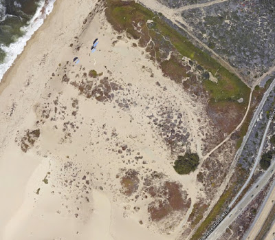
Railroad service to Retreat ended in 1979 when the Monterey Branch was reduced to Seaside. The oil services there were abandoned at some point as well, leaving today only impressions on the ice plant-covered sand where the oil tanks once stood. The railroad tracks have since been either removed or buried here with much of the area around the property developed to some degree. The property itself is now mostly Monterey State Beach, although the heart of the oil operation is closed to the public.

Official Railroad Information:
The site of Retreat as seen on Google Earth.
Vidrio first appeared in agency books around 1907 with no platform or services. In 1909, it was designated a C-class freight station but it then disappeared from books in 1910. By 1926, the station had returned renamed Retreat. In 1930 an A-class freight station with a platform was present, privately owned by Associated Oil and Standard Oil. It appeared on timetables in this time 124.3 miles from San Francisco via Watsonville Junction, Gilroy, and San José. It was also 5.7 miles from the Lake Majella end-of-track. The first reported spur at the site was 8 carlengths (400 feet) long, but that was later upgraded to 13 carlengths (640 feet) by 1951. It was reduced to an Additional Station in 1940 and added to the yard limits of Monterey in 1954. It was still present on timetables in 1979 when the branch line was truncated to Seaside, at which point the stop was abandoned.

Geo-Coordinates & Access Rights:
36.6˚N, 121.9˚W

The site of Retreat is located at the junction of Del Monte Boulevard and the access road for Monterey State Beach. The road is the former oil company service road and skirts around the former oil tank enclosure, which is closed to the public. Nothing of the stop remains and the tracks have been either pulled or buried beneath the Monterey Bay Recreation Trail.

Citations & Credits:
  • Southern Pacific Railroad Agency Books and Employee Timetables, 1899 to 1983. (Courtesy George Pepper, Duncan Nanney, and the California State Railroad Museum Archives).

Friday, July 10, 2015

East Monterey & Seaside

Seaside, as shown on the 1947 USGS Map.
The Salinas Valley Railroad passed through the future town of Seaside as early as 1874, but it wasn't for another 14 years that the city came into being. In 1888, a New Yorker, Dr. John L.D. Roberts, founded the East Monterey subdivision in 160 acres of land he purchased from the his uncle, David Houghton. Roberts hoped to reap some profit off of the nearby Hotel Del Monte when he built his subdivision. By 1891, East Monterey had a post office and a Southern Pacific Railroad stop on the Monterey Branch of the Coast Division.

The railroad conveniently passed directly through the heart of East Monterey. The composition of the station structure is not currently known to this historian but records show that a station was present for the town. Beside the tracks, a siding of variable length—no longer than 500 feet—paralleled the mainline on the west side. A short spur running to the freight platform and station, meanwhile, sat on the east side of the mainline, just beyond the northern end of Hillsdale Street.
Seaside subdivision plan, c. 1908. This map shows the extension of East Monterey into the "Seaside Addition",
which marked the community's transformation. (Fine Art America)
The railroad tracks in Seaside, 1917. (City of Seaside Archives)
East Monterey became Seaside prior to 1899 and grew slowly into a middle-class American neighborhood. Then, rather suddenly in 1910, Roberts decided to invite the US Army to set up camp on a part of his land. Camp Gigling was established two years later and many of the original residents of East Monterey moved out in response, disliking the sudden military presence on their doorstep. In 1914, Seaside was decisively turned into a military town. When the US entered World War I in 1917, the base went into full operations. After the war, the community continued to decline into what many saw as a lower-income town, marring the reputation of Monterey and Pacific Grove. The Great Depression did little to help this as many settled in the town since property values were low. Because of the settlers and the military base, the community became one of the most multi-racial areas along the Central Coast. By the time World War II began, many of Fort Ord's families and auxiliary staff lived in Seaside and this fact continued until the base closed in 1994. In 1954, the town incorporated into its own city, independent of Monterey, and it has continued to grow since World War II. Seaside continues to be a mixed-ethnicity community but it is no longer low-income, today supporting many established hotels, a golf course, CSU Monterey Bay, and a naval academy.

Railroad service to the station increased through the 1930s and 1940s, probably reaching a height in the 1950s before declining rapidly as regular passenger services ended. Freight service to Seaside remained intermittently, although what it serviced is not entirely known. Numerous small freight concerns existed in the area but changed frequently. Which, if any, of them used the Seaside freight platform after 1954 is unknown currently. The station became the end-of-track when the branch was truncated in 1979 and remained on timetables until the abandonment of the branch by the Union Pacific Railroad in 1999. When the station structure was removed is currently unknown.

Official Railroad Information:
East Monterey probably first appeared around 1889 with a class-A freight platform. It was renamed Seaside by 1899. In the 1920s, the station's platform was downgraded to a C-class freight stop, meaning it had a platform and siding but no other facilities. The stop was located 123.3 miles from San Francisco via Castroville, Gilroy, and San José. It was also 6.7 miles from the Lake Majella end-of-track. Initially, it offered both passenger and freight service and included a 10-car (~500 foot) siding at the stop. The siding shrunk down to ~450 feet by 1940 and then ~250 feet by 1951. Regularly-scheduled passenger service, except for specials such as the Del Monte Express, ceased in 1963 and the siding disappeared from timetables at the same time. In 1979, the Monterey Branch was cut back, with Seaside becoming the new end-of-track. The station remained on timetables until the closure of the branch in 1999.

Geo-Coordinates & Access Rights:
36.61˚N, 121.85˚W

The site of Seaside is beneath the Cardinale Nissan dealership on Del Monte Blvd. The parking lot marks the extent of the spur and station property while the siding ran from the end of Holly Street to just southwest of where the right-of-way passes over Contra Costa Street. Access to the right-of-way is largely open in this area, except for the Nissan dealership.

Citations & Credits:
  • McKibben, Carol Lynn. Images of America: Seaside. Arcadia Press, 2009.

Thursday, July 2, 2015

Prattco

Prattco Spur as shown on a 1948 USGS Map.
In the years just after the end of World War I, activity in the area of East Monterey, modern-day Seaside, was on the rise. It was in this environment that Clarence "Sandy" Pratt established his Pratt Rock and Gravel Company sand quarry on the beach along a spur of the Southern Pacific Railroad's Monterey Branch.

Prattco began operations in East Monterey in 1921 where it ran a single-pit quarry on the beach, nestled between two small sand dunes that still sit there today. The original quarry was serviced by a short 5-car spur that ran alongside the main track with the freight platform situated between them. In the early 1940s, the spur was lengthened considerably, running between the dunes and toward the Monterey Bay 750 feet. This length apparently was too long and it was shortened slightly, to 640 feet, by 1954. While no formal station structure was located there except for the platform, the station did accept passengers and even occasionally had scheduled service. Its location close to Fort Ord Village likely made it a closer stop for some local residents.

In 1950, Prattco was purchased by Pacific Cement & Aggregates, Inc., which used the sand from this quarry for concrete, blasting powder, and stucco. PCA scraped medium-grain sand off the beach and the dunes for processing on site, where it is sorted and blended. Lone Star Industries, Inc., a major aggregate supplier on the Central Coast, eventually purchased all of PCA, including the Prattco plant. Lone Star continued to use the quarry for many more years, with it finally shutting down at the end of 1986. The spur was spiked at some point soon afterwards and it is unclear if the tracks still sit, although aerial imagery shows the path of the spur. Regardless, Prattco remained on timetables until the abandonment of the Monterey Branch in 1999.

Official Railroad Information:
Google Maps satellite view of the Prattco spur today. The spur is gone, as is
its switch, but the imprint of it can still be seen in the sand dunes.
Prattco first appeared in agency books in the late 1910s. It was recorded as having a class-C freight station, including a short platform. Employee timetables reported in the 1930s that Prattco was located 122.1 miles from San Francisco via Castroville, Gilroy, and San José. In addition, it was 6.2 miles from 7.9 from the Lake Majella end-of-track. Both passenger and freight services were offered at the stop, although the station was primarily a freight stop for the Pratt Company. A 5 carlength spur (~250 feet) was installed at some point and lengthened into a 15 carlength (~750 feet) spur in the 1940s. It was reduced to its final length of 640 feet around 1954. The station was demoted to an "Additional Station" in the 1940s but returned as a regular stop in 1963. Freight service to the station persisted after the end of passenger service, only formally ending with the closure of the branch in 1999.

Geo-Coordinates & Access Rights:
36.62˚N, 121.84˚W

The site of Prattco is in Sand City just to the right of the Fremont Boulevard southbound exit of State Route 1. The Monterey Peninsula Recreation Trail passes beside the site, as well. Access to the site is ambiguously restricted, but a lack of development in the area suggests trespassing is not discouraged. The old Prattco road, now covered in sand, can be found at the northern end of Fremont Boulevard.

Citations & Credits: