Showing posts with label Santa Cruz Branch. Show all posts

Thursday, September 25, 2025

Stations: New Brighton

Much like Robroy to the east, New Brighton served as a resort flag stop throughout its entire existence, catering specifically to a hotel and campground situated on a coastal terrace roughly midway between Aptos and Capitola stations. This area had been granted to Martina Castro as Rancho Soquel by the Mexican government on August 2, 1834. On August 28, 1850, Castro partitioned her property between her eight children, with this specific section passing to her second child, María Luisa Cota, wife to Jean Richard Fourcade, a French immigrant who adopted the Spanish name Ricardo Juan. While the subsequent sequence of events is not entirely clear, on January 19, 1863, the Fourcades’ 124-acre property were sold at a sheriff’s auction to Jeremiah David Hyde. Hyde was co-owner of the Santa Cruz Sentinel but left the next year for Visalia, where he became a prominent entrepreneur. His brother, Richard Eltinge Hyde, who ran a mercantile store downtown, briefly took over his brother’s affairs and properties before following him to Tulare County around 1867. Why the Hydes were interested in this section far away from downtown Santa Cruz is unknown—it may have simply been a real estate investment.

Pathfinders at New Brighton Beach, circa 1929. [Courtesy Pathfinders Club of San Jose – colorized using MyHeritage]

Prior to leaving Santa Cruz, Richard sold the property on April 20, 1866, to Thomas Fallon. Fallon, a brother-in-law to the Fourcades, wanted to harvest, process, and ship timber cut on his lands in the Soquel and Aptos forests. Hyde’s property was a perfect solution and was large enough for a sawmill and lumber yard. He also purchased an easement through Benjamin Porter’s adjacent land to the north to allow him to transport timber from his forest tracts to his mill and yard. Down a gully along the east border of the property, Fallon built a road to the beach where he may have erected a short pier. Little is known about this lumber operation or how long it operated.

The Chinese fishing community near New Brighton Beach, likely after it had already moved east toward Aptos or beyond, circa early 1880s. [Courtesy University of California, Santa Cruz – colorized using MyHeritage]

In 1874, grading crews of the Santa Cruz Railroad wrapped around the northern boundary of Fallon’s property. Even before the railroad was completed in 1876, former Chinese laborers set up a fishing colony on the beach just to the west of Fallon’s property, which soon became known as China Beach. Hundreds of boxes of fish were sent seasonally to nearby Soquel and Aptos Stations, with up to half of the county’s fish exports derived from this colony in 1877. The Chinese lived in ramshackle plank buildings constructed directly on the beach and used shallow hulled boats and seine nets to catch their fish. The close proximity of the colony to Fallon’s property led his property manager to evict the camp in 1878, even though it was technically on Hihn’s property. The fishermen moved east of the property boundary toward Aptos and continued moving annually until forced out of the county entirely in 1888.

Map of the Fallon Estate and New Brighton resort, undated. [Santa Cruz GIS A11-014]

The removal of the Chinese from the beach coincided with Fallon’s second attempt to profit off his scenic clifftop property. In the summer of 1877, he hired Captain J. W. Hammond & Son to run a resort called Camp San Jose, likely reflecting Fallon’s desire to attract wealthy families from his hometown. Hammond built several rustic cottages and cleared and leveled an area for a campground overlooking the bay. He also erected a modest boarding house on the cliff. It provided year-round lodging for guests and its dining room doubled as a dance hall in the evenings. The former haulage road down the gully became the campground beach access path, while a pier was built or the former one restored. Hammond personally ran a charter tour boat service from the pier. The San Jose Republic noted that the beach was pure sand with no undertow, two praises that were repeated over the years.

A group of people picnicking on New Brighton Beach, circa 1910s. [Courtesy UC Santa Cruz – colorized using MyHeritage]

The Santa Cruz Railroad probably established its flag stop at Camp San Jose in 1877, though the first mention of it is in the following year. While no photographs or official information regarding a station structure exists, the Sentinel reported in July 1880 that several San José boys vandalized the depot by tearing off the railing. The same article suggest that the structure was not railroad property, but rather Fallon’s. Andrew J. Hatch’s Official Map of Santa Cruz County, published in 1889, also implies a structure was located on the northeastern corner of the estate. The station appeared on public timetables from June 1881, shortly after the line was taken over by the Southern Pacific Railroad. Only the daily train in each direction stopped there.

Santa Cruz Sentinel advertisement for the New Brighton Hotel at Camp San Jose during the time of the Mangenbergs' management, published July 15, 1882.

The Hammonds ran Camp San Jose through the summer of 1881. By the end of their tenure, the resort had seen better days. As soon as Fallon took control of his property, he began making improvements. He planted thousands of ornamental and shade trees and laid out new pathways. He improved the camp’s large barn and outbuildings, and erected a two-story addition to the boarding house that could now support thirty bedrooms, in addition to several cottages. Fallon also probably demolished the pier at this time. A Sentinel article at the time likened the property to Brighton, England, because “as the visitor looks up and down the beach and out on the endless expanse of the ever-moving ocean, he, in imagination, sees the elite of Europe gathered on the deep-sounding sea shore.” Prior to the start of the 1882 season, Fallon leased the property to Kimball & Company, who hired Guido Mangenberg of San Francisco to run it. One of them, although it is unclear who, christened the boarding house the New Brighton Hotel.

Two women posing wearing seaweed dresses at New Brighton Beach, 1925. [Courtesy Capitola Museum – colorized using MyHeritage]

The hotel was opened in a grand celebration in June 1882. With the new additions came a bar room designed in imitation of a Comstock mine, which the Sentinel noted “is a beauty in its way.” The Mangenbergs began pushing the New Brighton Hotel as a destination resort, moving Camp San Jose down a line in advertisements. Fallon, either leading the charge or following the Mangenbergs’ lead, announced in December that Camp San Jose would be permanently rebranded New Brighton. Southern Pacific also acknowledged this change from October 28, 1882, when it renamed the station “New Brighton (Camp San Jose)” on timetables. Almost all mention of the old name disappeared by mid-1884. The Mangenbergs only lasted two seasons. They left in November 1883 and opened Avalon Gardens in Capitola the next year. Even before this, Fallon was planning his next move. In fall 1882, he announced a plan to subdivide the property into lots to sell to seasonal campers, much like Pacific Grove across the bay. Fifteen of his San José friends pledged to buy lots. The predecessors of the homes on the beach today may have begun at this time.

Women preparing food at New Brighton, 1931. [Courtesy San Joaquin County Historical Society and Museum – colorized using MyHeritage]

Still not ready to switch from resort owner to property developer, Fallon hired George Bailey of San Francisco to run the hotel and campground “as a quiet family resort” for the summer of 1884. He also left his bodyguard, Charles Barr, in New Brighton to act as his local agent. Barr assisted Bailey in daily operations there, though he was not known for his customer service etiquette. Prior to the start of the season, Fallon announced that a large and elegant new hotel would be erected. Tragically, these plans would never be realized. Fallon fell terminally ill from liver disease in the summer of 1884 and died on October 25, 1885. Immediately before his death, he leased 35 acres of the property—presumably encompassing all of the resort—to Barr for a five-year-span at $100 per year beginning November 1. Shortly afterwards, Emmanuel T. Trout sued Fallon’s estate to recover nearly $2,000 that he had spent maintaining the New Brighton resort, though when precisely he was responsible for this is unclear. Trout may have been hired to upgrade the property after the Hammonds left in 1881, or he may have served as property manager before Barr leased the property.

Landslide on the Southern Pacific track west of New Brighton along Park Avenue, 1909. [From the Neil Vodden Collection, courtesy Jack Hanson – colorized using MyHeritage]

The aftermath of Fallon’s death led to the temporary collapse of New Brighton as a resort. The name quickly became associated with the beach rather than its namesake hotel on the cliff’s edge, though the boarding house remained a feature until it was demolished in 1939. Despite its seeming decline, in January 1887 the station appeared in Southern Pacific agency books for the first time, while on July 10 it also appeared on employee timetables. However, the station structure disappears from all sources shortly afterwards and was likely demolished sometime in the early 1890s. In July 1890, the resort was subdivided into five lots averaging eight acres each and transferred to Emmanuel Trout, William Fallon, Isabelle Brittan, and Fallon’s ex-wife, Carmel. Following the death of Trout in 1897, Carmel sued his estate to reclaim the property and by February 1898, she had purchased the other three lots. Earlier, in November 28, 1896, the public railroad timetable was reformatted and New Brighton disappeared. It was removed from agency books and employee timetables the next year. Carmel transferred her newly-consolidated property sometime in the early twentieth century to a niece, Amelia Littlejohn, and her husband, Robert Parker, who continued to run the resort as a campground and picnic area.

Map of the Partition of the tract of land known as New Brighton, January 31, 1898. [Santa Cruz GIS 012M16]

The enduring popularity of New Brighton’s beach in the early 1900s prompted Southern Pacific to re-establish the station, although the location was only marked with a simple sign and never featured any services or facilities. It was first listed as an additional stop on employee timetables on December 1, 1901. In September 1907, it was added to the schedule of stations, while in January 1908 it returned to agency books as well. Despite this sudden elevation in status, nothing seems to have changed at New Brighton during this time—the nearby beach remained a tourist destination each summer, picnickers returned year after year to Fallon’s forest for feasting and dancing, and campers continued to pitch their tents on the old Camp San Jose site. The old hotel and dance hall may have returned to purpose, but neither are mentioned in the sources. From all appearances, the resort had evolved into an informal venue for countless summertime events and the railroad took advantage of this fact.

Clifftop cabins at New Brighton resort, early 1930s [Courtesy Harry Kay – colorized by MyHeritage]

Amelia Parker’s death in November 1924 led to Robert’s retirement the next year. The property was acquired by a cousin, Geraldine G. Moore, a granddaughter of Thomas Fallon. She leased the resort to Frank Thrane of San Francisco, who planned to add a service station, grocery store, and ice cream stand. It is unclear if these were ever built, but Thrane built a new dance hall, erected new cottages atop the cliffs, and added an electric-powered community kitchen. In 1933, the adjacent property once belonging to Frederick Hihn was sold to the State of California to create what would eventually be named New Brighton State Beach. The large undeveloped western half of the Fallon estate, which had long served as the Parker family’s farm, was soon acquired by the state and developed into the state park’s campground. The resort, though, remained separate despite the fact that the state park took its name as its own. Over the next several years, waves of Civilian Conservation Corps recruits operated out of nearby Camp New Brighton (the National Guard’s former Camp McQuaide) to build seawalls, nature paths, camp sites, and parking lots for the new state park.

The Civilian Conservation Corps station at Capitola called Camp New Brighton, 1938. [Annual Report of Fresno District, CCC – colorized using MyHeritage]

This heavy activity in the area may have helped keep railroad passenger service on the Santa Cruz Branch alive through most of the Great Depression. Indeed, New Brighton Station survived beyond the end of regular passenger service in 1938. It remained available for excursion trains, but few likely stopped there, especially after the United Stated entered World War II. Southern Pacific petitioned for the station’s abandonment on April 9, 1946, stating that no passenger or freight business had been transacted there for over two years. The Interstate Commerce Commission approved and the station was abandoned on May 5. Because there were no structures other than a sign, there is no surviving evidence of the station today. The area is now heavily overgrown with eucalyptus and ivy.

Map of the Lands of the Potbelly Beach Club, October 1982. [Santa Cruz GIS A80-658]

The New Brighton resort property contracted gradually from the 1950s. Before 1955, the single-road subdivision along Pinetree Lane in the forest Thomas Fallon had planted seventy years earlier was developed. Geraldine Moore and her son, John W. Sinclair, also sold several lots atop the cliff, where they kept their own home as well. Meanwhile, Moore and her predecessors had leased out portions of the beach for shacks and cottages. In an attempt to head off an eminent domain land grab from the state, which hoped to annex the New Brighton resort property to the state park, mother and son sold the beach in 1965 to their tenants, who organized themselves into the Potbelly Beach Club. Moore and Sinclair remained members of the club and residents until their deaths in 1973 and 1988 respectively. The Potbelly Beach Club survives today as a private seaside community, a last reminder of a simpler time when vacationers spent the entire summer at the beach.

Members of the Ludden and Franich families at their beachhouses on New Brighton Beach, published in the Santa Cruz Sentinel August 12, 1962. [Colorized using MyHeritage]

Citations & Credits:

  • Robert R. Baldwin, “Record of Survey Map of the Lands of the Potbelly Beach Club, located in Soquel Rancho” (May 1967). [Santa Cruz County GIS A80-658]
  • Henry E. Bender, Jr., “SP Santa Cruz Branch [SP72]” (December 2017).
  • Margaret Koch, “Ripples From The Past,” Santa Cruz Sentinel, 10/21/1973, 21:1-5.
  • Sandy Lydon, Chinese Gold: The Chinese in the Monterey Bay Region, 20th anniversary edition (Capitola, CA: Capitola Book Company, 2008).
  • “Map of Partition of the Tract of Land Known as New Brighton, Part of the Rancho Soquel in the County of Santa Cruz,” surveyed July 1980 by Wright and Pioda, filed for record January 31, 1898 by Edward Martin, county recorder, by B. R. Martin, deputy recorder. [Santa Cruz County GIS 012M16]
  • "New Brighton Road, Soq. Ro." [Santa Cruz County GIS A11-014]
  • Ronald G. Powell, The Tragedy of Martina Castro: Part One of the History of Rancho Soquel Augmentation (Santa Cruz, CA: Zayante Publishing, 2020). [Amazon link]
  • Railroad Commission of the State of California, Decision No. 38845 (April 9, 1946).
  • Santa Cruz Evening News, Santa Cruz Evening Sentinel, Santa Cruz Sentinel, Santa Cruz Sentinel–News, and Santa Cruz Surf, various articles.
  • Southern Pacific Railroad, timetables and agency books (1887–1908).
  • Carolyn Swift, "Draft Historic Context Statement for the City of Capitola" (June 24, 2004).

Friday, August 23, 2024

Bridges: Live Oak Area

The Santa Cruz Railroad had a goal—indeed a requirement—if it wanted to earn its first subsidy payment in 1874: it had to build 5 miles of operable railroad beginning in Santa Cruz and heading east. But this task would not be easy. The narrow-gauge right-of-way would have to cross the San Lorenzo River, Woods' Lagoon, the top of Schwan Lagoon, and Rodeo Gulch before it reached the 5 mile mark near the west bank of Soquel Creek. The largest engineering obstacle was obviously the river, while a long trestle was required to cross Woods' Lagoon. But four smaller trestles were still required before the railroad could achieve its initial goal.

The northern end of Schwan Lagoon with Loma Prieta in the distance, circa 1920. [University of California, Santa Cruz – colorized using MyHeritage]

Schwan Lagoon is today known as the eastern lake of Twin Lakes, though when the area was initially settled, it was a true lagoon, with brackish water flowing into the Monterey Bay. By the 1870s, the lagoon was mostly cut-off from the bay and its salinity had dropped substantially, though there was still a small outlet and the lake was sometimes inundated during king tides and winter storms. The west side of the lagoon had been owned by the family of Manuel Rodriguez since before California became a state, and his descendants would continue to own property there well into the twentieth century. The east bank, meanwhile, was owned by Jacob Schwan, a German immigrant whose name became associated with the lagoon. At the head of the lagoon, Leona Creek flows from the mountains through Arana Gulch and provides the lagoon with its most substantial source of freshwater. Two other unnamed feeders drain from to the east from nearby fields that were once scattered forests atop a coastal sandstone terrace. Between the creek and these feeders was the land of Henry B. Doane. It was over these creeks that the Santa Cruz Railroad had to cross in order to continue east toward Soquel Creek and Camp Capitola

Survey Map of East Santa Cruz showing property owners, circa 1870. Drafted by Thomas W. Wright, Santa Cruz County Surveyor. [Santa Cruz GIS]

After crossing Woods' Lagoon, passing through a narrow cut, and ascending to the top of the terrace, the Santa Cruz Railroad right-of-way reached Leona Creek. The original bridge over this year-round stream would have measured around 200 feet and was probably a trestle-type bridge, though no photographs have been found of the original structure. About 450 to the east, a bridge about 110 feet long crossed an unnamed seasonal feeder creek. Like the bridge before, this was likely of a simple trestle design. Continuing another 1,300 feet to the east, a short bridge probably around 70 feet long crossed the easternmost unnamed seasonal feeder creek of Schwan Lagoon. Again, this was likely a trestle style and would not have been very high above the ground.

The Southern Pacific Railroad's right-of-way through the East Side, circa 1890. [Santa Cruz GIS]

All three of these bridges suffered the same fate, though probably not at the same time. When the Southern Pacific Railroad took over the Santa Cruz Railroad and standard-gauged the tracks in 1883, the Leona Creek bridge was probably filled, with a wide culvert built at its center to allow the waters of the creek to pass under the right-of-way. The other two bridges may have just been widened initially since they were not very high above the ground.

Southern Pacific Railroad tracks through the Twin Lakes area, circa 1953. [UC Santa Cruz – colorized using MyHeritage]

Aerial photographs show that both of the eastern bridges had been filled by 1928, but the ground around them, especially the easternmost bridge, was still relatively clear of debris, suggesting the filling had occurred fairly recently, perhaps in the 1910s, when much of the local railroad infrastructure was improved. Culverts would have been built beneath both of these fills, too. However, in the mid-1950s, the site of today's Simpkins Family Swim Center and Shoreline Middle School was turned into an aggregate yard. In the process of creating this yard, the area was leveled and the seasonal creek bed was buried. This included any trace of the fill and culvert.

Lithograph of the residence of James Corcoran, circa 1880. [UC Santa Cruz]

To the east of Schwan Lagoon, another substantial lagoon had its origins in the Santa Cruz Mountains and Rodeo Gulch, through which its only significant freshwater source flowed. The west bank of this lagoon had been settled in the mid-1850s by James Corcoran, an Irish immigrant, who owned the property through which the Santa Cruz Railroad was built in 1874. He would eventually subdivide and the tracks would form his northern boundary with Philip Legett and Martin Kingsley. East of Rodeo Gulch, the right-of-way passed through the land of V. W. Thompson. The railroad faced no substantial obstacles across this 0.6-mile-long stretch that would become known as Del Mar or Cliffside in later years. But Rodeo Gulch itself required the most substantial bridge in the Live Oak area.

U.S. Forestry Service aerial survey showing Southern Pacific Railroad trackage through Live Oak, 1948. [UC Santa Cruz]

The bridge over Rodeo Gulch was the third most substantial structure between Santa Cruz and Soquel Creek, measuring about 300 feet long, but it probably still only required a trestle bridge due to the low flow of the creek through Rodeo Gulch. As with the bridges above, no photograph seems to exist of the original bridge over Rodeo Gulch nor does the Santa Cruz Sentinel report on the type of structure erected here. Like the other three bridges, the structure across Rodeo Gulch was either replaced or modified when the Southern Pacific Railroad standard-gauged the track in 1883. At the same time, it was shortened a little, with fill replacing some of the trestlework at either end. This second or modified bridge was replaced again, possibly as late as the 1920s, by a concrete viaduct-style bridge with regularly spaced support piers and a ballast deck. The fills on either side may have been extended further when this was installed.

The current railroad bridge over Rodeo Gulch, December 2018. Photo by Derek Whaley.

Of the original four Live Oak railroad bridges, only the Rodeo Gulch bridge survives. Two of the those at the head of Schwan Lagoon are now fills with culverts running beneath them, while the third has been completely buried and sits unnoticed beside the Simpkins Family Swim Center. Frustratingly for railroad explorers, this non-existent fill is the only one that is easily accessible without trespassing on the Santa Cruz Branch Rail Line. It sits directly adjacent to the turnaround at Shoreline Middle School. However, the smaller surviving fill can be viewed and accessed from the end of Live Oak Avenue. The fill over Leona Creek and the bridge over Rodeo Gulch are inaccessible to the public. All four of these sites are owned by the Santa Cruz County Regional Transportation Commission and are scheduled to be included as part of the county's coastal rail and trail project.

Citations & Credits:

  • Donald T. Clark, Santa Cruz County Place Names: A Geographical Dictionary, second edition (Scotts Valley, CA: Kestrel Press, 2008).
  • Bruce MacGregor, The Birth of California Narrow-Gauge: A Regional Study of the Technology of Thomas and Martin Carter (Stanford: University Press, 2003).

Thursday, December 1, 2022

Bridges: Woods Lagoon

The area known as Twin Lakes referred to a section of unincorporated Santa Cruz County land between Woods Lake and Schwan Lake, both actually lagoons formed at the outlets of Arana and Leona Creeks respectively. While Schwan Lagoon retains much of its wetland charms, Woods Lagoon endured a substantial transformation in the 1960s when it became host to the Santa Cruz Small Craft Harbor. Yet long before this event occurred, the lagoon suffered its first major human terraforming effort, when the Chinese workers of the Santa Cruz Railroad installed a bridge across its midsection in 1875.

Southern Pacific #2764 running a Sun Tan Special across the Woods Lagoon bridge, July 28, 1940. Photo by Wilbur C. Whittaker. [Jim Vail – colorized using MyHeritage]

Woods Lagoon was named after John Woods and Mary Ann Silvey of Georgetown, Ohio. The Woods family moved to California during the Gold Rush but soon gave up and moved to Santa Cruz County. In 1849, John worked at the Bennett mill on Love Creek (today's Ben Lomond). Soon, though, he applied for recognition of a tract of land that he had acquired on the west bank of Arana Creek, which was registered to he and his wife on November 14, 1849.

Woods Lagoon, ca 1895. [Santa Cruz Public Libraries – colorized using MyHeritage]

Over subsequent years, the lagoon became a popular picnic and swimming spot, and it also later became well known to duck hunters. When the Santa Cruz Railroad's surveyors arrived in 1874, the Woods sold them a right-of-way through their property. The completion of the railroad two years later led the Woods to sell substantial acres of their property to interested parties, though the family kept a large section for themselves until after John's death on October 11, 1887. One such party was Samuel Hall, who founded Lake Marina in 1880, in the process briefly renaming Woods Lagoon. His resort failed after only one season, though. Shortly before John Woods' passing, Foster N. Mott founded Camp Seabright in 1884 on a small twelve-acre tract beside the lagoon. As a result, Woods Lagoon was sometimes called Seabright Lake in promotional material.

Early Southern Pacific diamond stack locomotive hauling a strange mixed train over the Woods Lagoon bridge, ca 1888. [University of California, Santa Cruz, Digital Collections – colorized using MyHeritage]

Woods Lagoon proved to be a mostly insubstantial impediment to the railroad's Chinese construction crews. The western approach to the bridge required a shallow cut that John Woods and his son dug by themselves. Beyond that, the bridge crossed Woods Lagoon at the narrowest point. Although no photographs survive of the original narrow-gauge bridge, it is likely that the later standard-gauge bridge, enlarged by the Southern Pacific Railroad in 1883, was in fact just an upgrade to the original structure. The photographs that survive show an austere open deck trestle viaduct with sixteen redwood piling piers, all standing almost perfectly upright, and wood abutments at either end. Some of the fill material pulled out of the shallow cuts on either approach to the bridge may have been dumped at the ends of the bridge to  reinforce the abutments.

Excursion train passing over the Woods Lagoon bridge, July 7, 1950. Photo by Wilbur C. Whittaker. [Jim Vail – colorized using MyHeritage]

This structure remained across the lagoon until Spring 1911, when it was replaced with a sturdier, more modern design. The new structure was composed of eighteen redwood piling piers, all tilted inward to provide additional support. These supported a redwood girder closed ballast deck with concrete abutments on either end. The abutments were likely installed to help reinforce the fills behind them. This also resulted in a slightly shorter span across the lagoon, with the bridge measuring around 282 feet. Most historical photographs of the lagoon date to this period.

Southern Pacific survey map showing a proposed pedestrian sidewalk on the north side of the Woods Lagoon bridge, 1946. [Vasona Branch]

After over fifty years of relative peace and quiet on Woods Lagoon, things changed rapidly. In 1964, the U.S. Army Corps of Engineers dredged out the section of Woods Lagoon between the lagoon mouth and the railroad bridge in order to create the Santa Cruz Small Craft Harbor. Until this time, Santa Cruz did not have a proper harbor protected from the elements, and commercial use of the Santa Cruz Municipal Wharf, built in 1914, had declined to almost nothing. With the new harbor, residents would be able to safely protect their yachts, sailboats, and motorboats from the elements. In the process of creating the harbor, East Cliff Drive was bisected. To correct for this, a new vehicular bridge was extended from the end of Murray Street, which had previously ended at Seabright Avenue, to Eaton Street.

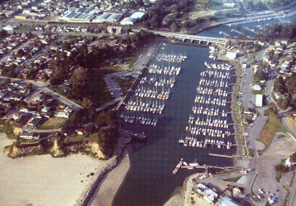
Santa Cruz Small Craft Harbor with the Glen E. Coolidge Memorial Bridge and railroad bridge at upper-center, 1973. [Santa Cruz Public Libraries]

Plans to replace the railroad bridge began in July 1968. The trestle viaduct blocked access to Woods Lagoon beyond the railroad grade. Plans for a new bridge were finalized in December 1969 and work began the next year. To maintain continuous rail service, the railroad bridge was built between the viaduct and the Murray Street bridge. Rather than a trestle, which would not allow boats to pass under it, the new design called for a concrete girder closed ballast deck bridge suspended above the lagoon via six concrete piers and two concrete abutments. The bridge reached a height of 31.88 feet above the mean tide line. To achieve this extra height, the bridge had to begin further back along the railroad grade, extending the final length of the bridge to 425 feet. Once the new bridge was completed, the old viaduct was completely dismantled. The expansion of the upper harbor began in 1972 and was completed the following year, adding 560 more berths for boats.

The bridge over the Santa Cruz Small Craft Harbor, 2017. [Derek Whaley]

The 1971 railroad bridge remains in place today and is one of the more recent bridges along the Santa Cruz Branch Rail Line. However, due to the closure of parts of the line further to the east, the bridge is only currently used for maintenance-of-way vehicles.

Geo-Coordinates & Access Rights:
Western abutment: 36.9681, -122.0036
Eastern abutment: 36.9681, -122.0022

The Woods Lagoon bridge is one of the easiest railroad bridges to view since it runs directly to the north of the Glen E. Coolidge Memorial (Murray Street) Bridge over the Santa Cruz Small Craft Harbor. It can also be viewed from below by parking at the northern end of the Mariner Park Way parking lot off Atlantic Avenue and taking the road under the bridge alongside the harbor. Another road beneath the railroad bridge is accessible off Murray Street on the east side of the harbor. As with the entire Santa Cruz Branch Rail Line, the railroad right-of-way is owned by the Santa Cruz County Regional Transportation Commission and any walking along the tracks without permission is trespassing.

Citations & Credits:

  • Clark, Donald. Santa Cruz County Place Names: A Geographical Dictionary, second edition. Santa Cruz, CA: Otter B Books, 2002.
  • Santa Cruz County GIS maps.
  • Santa Cruz Sentinel. Various articles 1874–1973.

Thursday, June 2, 2022

Stations: Farley

Hear it!
Or watch it!

Claus Spreckels was a prominent individual within Santa Cruz County throughout his life. By 1871, he was already becoming the sugar king, importing 125 tons of raw sugar per day from Hawaii, China, the Philippines, Indonesia, and isolated areas of California to his refinery in San Francisco. But in 1872, he became interested in refining sugar from beets to maintain his thriving empire. He turned to Santa Cruz County and settled his eyes upon roughly 1,000 acres of Rancho Aptos.

Stereograph of the Aptos Hotel, late 1870s, by C. W. J. Johnson. [California State Library – colorized using DeOldify]

Rancho Aptos had been a Mexican land grant given to a member of the Castro family, Rafael de Jesús Castro, in 1833. Castro continued to hold most of the land for the next forty years, primarily using the sprawling marine terrace to raise cattle. However, he also built a 500-foot-long pier near the mouth of Aptos Creek around 1850, from which he shipped lumber, flour, and cattle hide. This was extended another 500 feet in 1867 by Titus Hale, allowing larger ships to dock at the pier. Hale used the pier during these years to ship cords of oak to San Francisco, where it was used to heat homes during the winter. Castro finally relinquished ownership of most of his property in 1872, when his wife, María Soledad Cota, abandoned him. Spreckels swooped in and bought it for $80,000.

Lithograph of Claus Spreckels, ca 1875. [Public domain]

In the grand scheme of his enterprises, Spreckels’ operations in the Aptos area were minor, although not insignificant. There were signs that the region was primed for beet growing and Spreckels needed to experiment before expanding his operations. However, Santa Cruz County was exceptionally isolated, with only a few rugged mountain roads and steamships providing ways out. To the south, however, the Southern Pacific Railroad had opened a new route to San Francisco the previous year. To make shipping goods easier, Spreckels joined with Frederick A. Hihn to finance and support the construction of the Santa Cruz Railroad, which passed through his property on its way to Pajaro in 1875. Meanwhile, Spreckels began planting beets while closely observing the activities of the nearby California Beet Sugar Company, based out of Soquel. Spreckels' precise relationship, if any, with this firm is unclear, and it is unknown if he ever produced a commercial crop at his Aptos property. Nonetheless, he saw the potential of Aptos as a tourist destination and continued to invest in the area.

Engraving of the Aptos Hotel complex, late 1870s. By W. W. Elliott & Company. [University of California, Santa Cruz, Legacy Digital Collections]

On May 22, 1875, Spreckels opened the luxurious Aptos Hotel above the cliffs between the railroad tracks and the Monterey Bay south of Aptos. The Santa Cruz Sentinel of March 27, 1875, says of the hotel complex:

Thursday, May 5, 2022

Curiosities: Returning Commuter Service to the Santa Cruz Branch Rail Line

On the evening of February 26, 1940, something momentous happened in Santa Cruz County. Earlier in the day, a massive rain storm had passed over the Santa Cruz Mountains causing landslides and sinks in several places along the Southern Pacific Railroad's branch line over the Santa Cruz Mountains. The evening commuter train to San Francisco could not return across the mountains so buses were brought in to collect passengers in Felton and shuttle them to Santa Cruz, where the train took them to the Bay Area via Watsonville Junction and the Coast Division mainline. Nobody knew it at the time, but this evening train was the last regularly scheduled commuter train to run in Santa Cruz County.

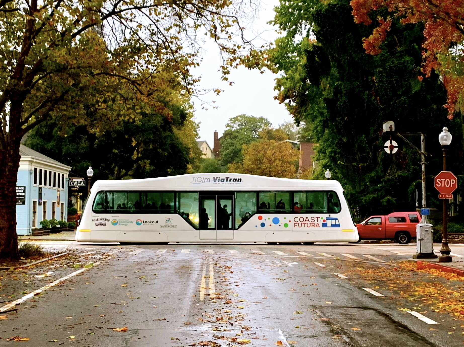
The Coast Futura demonstration electric trolley on Chestnut Street, October 2021. [Coast Futura]

Over eighty years have now passed since Santa Cruz County last had regular commuter service on any of its lines. Several attempts have been made over the decades to revive service in both the mountains and along the coast, however. While the former has become increasingly unlikely as the years march on, the latter remains possible since the tracks are still in place between Watsonville Junction and Davenport. Indeed, the entire route had been in daily use as a freight line until 2010, when the Santa Cruz Portland Cement Company plant in Davenport closed, and parts of it have remained in continuous use to the present.

Southern Pacific Railroad survey photo showing storm damage in Laurel, April 9, 1940. [Bruce McGregor]

Following the end of rail transportation across the mountains in 1940, Southern Pacific shifted to providing bus service through Pacific Greyhound. The railroad did this as a cost-saving move, but gathered support for it through lies and half-truths. In 1940, the company promised efficient commuter bus service, at same or similar prices, and the same level of support provided to rail passengers. It also resumed seasonal Sun Tan Special excursion trains, now via Watsonville Junction, to the relief of the Santa Cruz Seaside Company and many other summer businesses. Yet World War II allowed the company to reduce its services substantially and back out of many of its commitments.

Sun Tan Special at the Boardwalk, mid-1950s. [Joshua Reader]

The end of the war marked a return of demand for passenger service. In 1946, the local railroad agent, A. L. Andrews, stated that commuter service would be made available if there were a demand for it. The Sun Tan Special returned in June 1947 to much hype and signalled a return to normalcy after the war. The service continued every summer until Labor Day 1959. Other hired excursion trains resumed too beginning in May 1947, taking visitors to the Santa Cruz Beach Boardwalk, Davenport, and Henry Cowell Redwoods State Park (Big Trees), and these continued to operate through 1965, after which all forms of passenger service were discontinued in the county and the railroad tracks were downgraded to light freight-only status.

Sun Tan Specials at the Santa Cruz freight yard awaiting a return to San Francisco, 1950s. [Jim Vail]

These hints at passenger service did not satisfy locals, though. While seasonal tourist service enlarged Southern Pacific's coffers, locals were left only with year-round freight and undependable bus service. The local train stations, mostly servicing freight customers, continued to sell bus and rail tickets to the public, but they were poorly patronized and most were closed by the mid-1950s. A system-wide bus strike in 1952 gave hope to potential customers that commuter service would return to Santa Cruz County; however, Southern Pacific admitted that it did not have enough passenger cars to support commuter service even if it wanted to, which it did not. A 1959 Sentinel editorial outlined the plight of the railroads and how little interest Southern Pacific had shown toward maintaining any passenger service in Santa Cruz County whatsoever. From subpar passenger coaches on excursion trains to poor upkeep of the Santa Cruz Union Depot to the reduction of freight service to rural stations, the editor made it clear that Southern Pacific had failed in its duty to the county.

Southern Pacific diesel locomotive switching freight cars at the Santa Cruz yard, 1960s. [Jim Vail]

From 1966, Southern Pacific fought any attempt to return passenger service to the county. The railroad was entirely in favor of a buy-out, though. As early as 1971, Southern Pacific expressed interest in leasing or selling Santa Cruz County's trackage to a third party. This would allow passenger service to resume, force the third party to maintain the tracks, and also allow Southern Pacific to bypass its workers' union. Unfortunately, Amtrak, which formed in 1971, was not interested in reviving passenger service since its main focus was on long-haul routes. However, in 1974, a feasibility study revealed that a revival of the Sun Tan Special could be economically feasible if enough rolling stock could be earmarked for the service. Despite strong support by State Senator Alfred Alquist, Amtrak decided against running an experimental service to Santa Cruz at this time.

The three routes assessed in the 1977 California Department of Transportation feasibility study.

Throughout the rest of the 1970s and 1980s, Southern Pacific remained opposed to any expansion or continuation of passenger service in the Bay Area. Even local government-controlled commuter systems in the Santa Clara Valley could make no headway with the railroad. Its position was that anyone interested in reviving commuter service on its rails would have to buy or lease the route first. Proposition 5 (1974) provided state funding for local transportation initiatives, including for the maintenance of rights-of-way, purchasing of rolling stock, and supplementing of transportation income. A feasibility study conducted by the California Department of Transportation in 1977 found that restoration of commuter service along the Santa Cruz Branch was a viable option.

A Southern Pacific freight train heading south beside Davenport, 1988. [Drew Jacksich]

Santa Cruz County Regional Transportation Commission (RTC) reports released in 1980 and 1983 also indicated the feasibility of commuter service along the Santa Cruz Branch, although it would have to be subsidized to not run at a loss. The earlier report championed daytime commuter and nighttime freight service, while the latter study found that jointly operated daytime service was preferred. The 1983 report estimated annual ridership would be 335,800 to 568,550 passengers, 75 percent of whom would be commuters. The system would use diesel trolley cars slightly larger than a bus to run 24 trips per day from 7:00am to 7:00pm. The most patronized stops would be Watsonville, Capitola, and Santa Cruz, although the proposed service would also include stops for UCSC, Aptos, Soquel, Live Oak, and the Santa Cruz Beach Boardwalk. The annual operating costs were estimated at between $343,000 to $588,000, and state subsidies could cover up to $700,000.

Southern Pacific freight train hauling ballast through Watsonville, early 1980s. [WorthPoint]

Warren Weber, chief of rail service for Caltrans, suggested that the most viable option for the county was to buy the right-of-way. As expected, Southern Pacific balked at any suggestion that passenger service could resume on the freight-only, "Salad Bowl Express" route. The railroad insisted that any commuter service would interrupt its produce shipping schedule in Watsonville, and that freight was the only source of potential railroad revenue in the county. Opposition also came from the shippers themselves, 52% of whom stated that any change in shipping time would disrupt their service. Lastly, a vocal minority of local leaders came out against any restoration of commuter service, citing the possible fiscal deficit that could result from the service, competition with the existing public transportation network, and the long journey time of the service. The RTC decided to defer responsibility to the Santa Cruz Metropolitan Transit District (METRO) in July 1983 for them to conduct their own feasibility study.

One of the Santa Cruz Big Trees & Pacific Railway locomotives beside the Boardwalk, 1989. [ATOMIC Hot Links on Flickr]

The earlier studies prompted the formation of the first community action group, Renaissance of the Railroad, in August 1980. Its goal was to restore seasonal excursion service to the Santa Cruz Branch by working with a private operator. The RTC supported the venture and provided limited staff resources to investigate the option. Renaissance estimated that the cost of a two-year pilot program would be $646,000. The disastrous storm of 1982 provided the county with an opportunity to act. The Olympia part of the Santa Cruz Branch was damaged in the storm and Southern Pacific was no longer interested in catering to the two remaining freight customers along the line. As a result, Norman Clark of Roaring Camp Railroads stepped in and bought the 8-mile section from Laurel Street in Santa Cruz to the end of track at Eccles north of Felton for around $2 million. In 1986, the first recreational passenger train of the Santa Cruz Big Trees & Pacific Railway ran from Felton to the Santa Cruz Union Depot. The next year, service was extended to the Santa Cruz Beach Boardwalk. The service has run seasonally ever since. Although Clark had said that he would support a commuter service along the line, no such service materialized.

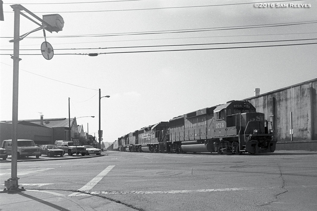
A Southern Pacific freight train heading through Watsonville to the mainline at Watsonville Junction, mid-1980s. [Sam Reeves]

Meanwhile, others worked to resolve the commuter rail impasse along the Santa Cruz Branch. Following a year of research, METRO decided unanimously to put the matter to a public vote. Measure A (1984)'s goal was to secure state funding provided by Proposition 5 for the research and development of fixed guideway public transportation systems in the county. While some of the touted ideas included a downtown-beach monorail, a Capitola to Santa Cruz streetcar line, movable walkways, and light rail, the heart of the idea was the restoration of commuter rail service. Unlike later measures, this one had the full support of all local politicians. If passed, the measure could secure around $11 million in funding from state and national agencies. On November 6, citizens voted overwhelmingly in favor of Measure A with 83% voting "yes." Commuter rail was back on the table.

Potential locations for stops of along an aerial tramway, 1989. [Santa Cruz Sentinel]

Until June 1985, submissions were solicited by METRO to explore the range of fixed guideway systems that the county could potentially support. A federal consultant submitted a preliminary report in November that ruled that the best option for a fixed guideway system was between Pogonip or UCSC and the Boardwalk via downtown, primarily because it would provide easy transportation for tourists and would have public support. At the same time, the consultant rejected every other existing option in the county because they would conflict with existing conveyances. Frustratingly, this meant that federal funds could only be applied to an entirely new fixed guideway rather than utilizing the existing Southern Pacific right-of-way. While many options for this new route were discussed, an aerial tramway from UCSC to the Boardwalk via Harvey West Park and downtown was considered the best solution.

depot.jpg
The freight and passenger depot at Watsonville Junction, 1980s. [Watsonville Memories]

The October 17, 1989 Loma Prieta Earthquake briefly led to a resurrection of commuter passenger service for Watsonville. For three weeks beginning October 23, Southern Pacific restored passenger service to Watsonville to help commuters get to the Bay Area, since many of the local roads were barely usable. Around 40 commuters used the service, with stops at Salinas, Gilroy, and Morgan Hill adding another 130 passengers. The journey to San José took about an hour. Unfortunately, the service came to an abrupt end on November 10 due to insurance and liability problems, and it was never reinstated.

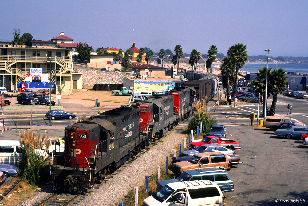
A triple-header Southern Pacific freight train on its way to Davenport, 1987. [Drew Jacksich]

Also in 1989, a second countywide report revealed that using the existing Santa Cruz Branch was by far the most logical solution for commuters. Initial estimates suggested that up to 6,000 people would use the service per day between La Selva Beach and Natural Bridges State Park, as well as between Felton and Santa Cruz. It further estimated that over 30,000 daily commuters would ride the train by 2005. The preferred means of conveyance were diesel-powered railroad cars, or railbuses, that could hold up to 100 people each. Spur lines to Cabrillo College and the Santa Cruz Metro Center were planned.

Southern Pacific freight train crossing the Manresa State Beach bridge, 1996. [Sam Reeves]

The 1990s saw an increase in discussions regarding the feasibility of restoring commuter passenger service to the county. Proposition 116 (1990), which gave state subsidies for alternative transportation projects, passed with 60% approval in Santa Cruz County. In 1995, another feasibility study found that using the Santa Cruz Branch for commuter service was still viable. Yet the overwhelming defeat of Proposition 185 in November 1994, which would have allocated substantial funding to local rail projects, likely made any expansion of rail services in the county infeasible. Meanwhile, at the end of 1991, financial difficulties forced METRO to pass responsibility for the project back to the RTC, which formed a Fixed Guideway Oversight Committee in response. The RTC has been responsible for all county railroad projects ever since.

Staff photo from the Sentinel showing Barbara Rodak of RAILS at her home in Aptos, August 16, 1993.

Proposition 116 and the railbus plan prompted the creation of a community action group, Community Rail Transportation, which lobbied local governments to support commuter rail. In response, another group, Aptos-based Right-of-way Alternatives In Local Suburbs (RAILS), formed to oppose any expansion of rail services and to convert the railroad right-of-way to a hiking/biking trail. Around the same time, Santa Clara County Supervisor Rod Diridon announced his support for restoring the Sun Tan Special by any means necessary, while Santa Cruz County Supervisor Gary Patton became the first loud voice against restoring passenger service. He feared that extending commuter rail service to Santa Cruz County—which he admitted would be financially viable and a generally successful idea—would turn the county into a satellite of the Silicon Valley. It was a short-sighted sentiment that was already contradicted by the reality that Santa Cruz had long been considered a part of the wider Bay Area.

The "Return of the Sun Tan Special" train at Aptos, May 18, 1996. [Aptos Museum]

Debate continued throughout the late 1990s even as no further progress was made. In 1996, County Supervisor Walt Symons came out vocally in support of converting the Santa Cruz Branch to a hiking and biking trail, surely not the first local official to do so but one of the first to make their opinion public. By 1998, a plan was in place to purchase part of the railroad's right-of-way to build a county-wide bike path, but the California Transportation Commission rejected using Proposition 116 funds for the project. Meanwhile, pro-rail supporters finally got their long-sought return of the Sun Tan Special that year when three demonstration runs from Watsonville Junction to the Boardwalk were conducted by Amtrak and RegioSprinter. All three were successful but did not convince Union Pacific (which had taken over Southern Pacific that year) of the viability of regular or seasonal passenger service along the Santa Cruz Branch. A feasibility study conducted by the RTC in 1999 reported that commuter service would cater to no more than 5,000 daily riders, thereby making the prospect unappealing.

Official logo for Santa Cruz County Friends of the Rail & Trail.

At the turn of the millennium, Santa Cruz County's options for restoring commuter rail were slim. After decades of research, funding applications, and public debate, the RTC's commissioners were prepared to drop the concept from its 25-year plan. But they didn't. Instead, with public encouragement and the support of the newly-formed Santa Cruz County Friends of the Rail & Trail (FORT), the commissioners dug in their heels and bought the Santa Cruz Branch from Union Pacific using all funding sources they could find. Negotiations with the railroad began in 2002 and continued for a decade. During this time, the CEMEX-owned Santa Cruz Portland Cement Company refinery in Davenport closed, ending over a century of freight traffic along the North Coast. Freight traffic along the Roaring Camp-owned Olympia Branch had also come to an unofficial end when ProBuild absorbed the San Lorenzo Lumber Company and shifted to using trucks.

First run of the Iowa Pacific train on the Santa Cruz Branch Rail Line, November 2012. [Derek Whaley]

In 2012, the RTC finally closed escrow on the Santa Cruz Branch Rail Line (SCBRL) for a price of $14.2 million, taking heavily from Proposition 116 funds. The purchase required that the line be used for freight and passenger service. Union Pacific's contracted common carrier along the line, Sierra Northern Railway, was uninterested in providing the latter and terminated its contract. Iowa Pacific Holdings took over under the subsidiary Santa Cruz & Monterey Bay Railway and brought in a vintage diesel locomotive and consist to provide seasonal excursion service along the line. It also took over freight duties in Watsonville. For three years, things were looking bright. In 2014, a plan was completed that integrated the county's rail and rail-trail future with that of Monterey County. The next year the RTC completed a feasibility study setting out the path forward to restore commuter services in the county. And finally in 2016, the passage of Measure D allocated 25% of a sales tax increase to rail and trail projects. Yet trouble was brewing.

Official advertisement from Greenway, formerly the Great Santa Cruz Trail Study Group, 2017. [change.org]

The end of regular freight service outside Watsonville combined with a poorly-maintained right-of-way and the gimmicky nature of Iowa Pacific's excursions added fuel to the fire of the anti-train lobby. Trail Now was formed in 2013 to promote the idea of removing the railroad tracks and building a multimodal trail. The next year, the Aptos Rail-Trail Investor Group formed to petition more formally against the restoration of rail services throughout the county. This grew into the Great Santa Cruz Trail Study Group and, ultimately, Greenway in 2017. While touting itself as a grassroots organization of like-minded local residents, in reality it is run by wealthy property investors and tech millionaires whose only formal plan is to disrupt and delay any decisions related to using the SCBRL.

A section of track suspended above a washout near Watsonville Slough, October 2017. [Derek Whaley]

Not all problems were caused by rail opponents, though. In 2016, Iowa Pacific found itself in legal and financial trouble. It eventually announced its decision to abandon its contract in Santa Cruz County in 2017, leaving the RTC in a tough position. Around the same time, heavy winter rains caused a major washout beside Watsonville Slough, making all rail transportation impossible beyond that point except by Roaring Camp or smaller maintenance-of-way vehicles. State and federal regulators, mixed with Greenway obstacles, delayed repairs until 2019. In the meantime, Progressive Rail was brought in as the new common carrier, operating as the St. Paul & Pacific Railway, under similar conditions as its predecessor. However, those conditions were dependent on the repair and upkeep of the SCBRL, which was the responsibility of the RTC. Greenway has ensured that every obstacle possible falls in the way of the RTC performing its duties.

The Coast Futura electric trolley running alongside a section of the rail-trail, November 2021. [FORT]

The release of the Unified Corridor Investment Study in 2019 paved the way for the RTC to finally develop the SCBRL properly. In December 2020, the first of many segments of trail opened alongside a portion of the SCBRL, with a second segment opening in July 2021. In October, a commuter demonstration Coast Futura electric trolley ran in both Watsonville and Santa Cruz to general acclaim. This coincided with the RTC staff's recommendation to adopt a similar modern electric passenger trolley as the preferred technology for use in a commuter rail system along the SCBRL.

One of the two Santa Cruz Big Trees & Pacific Railway locomotives trapped in Watsonville performing common carrier duties on behalf of Progressive Rail, May 2021. Photo by Tarmo Hannula. [Santa Cruz Good Times]

But Greenway has continued to obstruct in whatever way possible. An influential member was elected to the Santa Cruz County Board of Supervisors in November 2020. He quickly worked to split the RTC evenly between pro- and anti-rail commissioners. The obvious impasse this would present prompted Progressive Rail to throw in the towel. It contracted out its common carrier duties to Santa Cruz Big Trees & Pacific Railways, which had bought two diesel locomotives to supplement its fleet in 2018 only for them to become stranded in Watsonville because of the RTC's failure to keep the line operable. In early 2022, the RTC proposed revoking Roaring Camp's right to operate as a common carrier along the Olympia Branch. This was part of a grander attempt by the Greenway-influenced RTC to abandon the SCBRL. When this failed, Greenway gathered signatures to put a new measure on the June 2022 primary ballot: Measure D. The measure attempted to force the RTC to abandon the SCBRL and strip all language relating to rail transit from the 20-year general plan.

Concept drawing of the Santa Cruz Branch Rail Line beside a two-lane paved trail. [FORT]

Despite a very well funded campaign, Greenway and its Measure D lost on June 8, 2022, with the results an overwhelming endorsement for shared rail and trail usage along the SCBRL. With the status quo maintained and Greenway reeling from the defeat, it is up to the RTC, Progressive Rail, and Roaring Camp Railroads to decide Santa Cruz County's railroad future. Feasibility study after feasibility study dating to the 1970s has shown the strong potential of commuter services in the county, yet still the residents of Santa Cruz County wait for the promises of Measure A and Proposition 116 to come to fruition. Will the Sun Tan Special return? Will electric trolleys run commuters between Santa Cruz and Watsonville? Will Santa Cruz County ever rejoin the California passenger rail network? Only time can tell.

Citations & Credits: