Showing posts with label former railroad companies. Show all posts

Thursday, June 4, 2026

Railroads: Dougherty Extension Railroad

The Santa Clara Valley Mill & Lumber Company’s mill had run out of timber. Since 1879, the company had been processing timber harvested from the headwaters of Zayante Creek 5.4 miles north of Felton. The opening of the South Pacific Coast Railroad through the same valley in May 1880 greatly accelerated the speed that the company could export its products to the Bay Area and beyond. Shortly after the railroad was completed, the company added a two-mile-long spur that began as a switchback and descended from the railroad grade to today’s East Zayante Road and then continued north to the mill at the confluence of Mountain Charlie Gulch and Zayante Creek. For six more years, the mill churned out millions of board feet of lumber and other timber products, then everything fell apart.

Mill worker families outside the Santa Clara Valley Mill & Lumber Company mill at Dougherty's, circa 1890. [Courtesy WorthPoint – Colorized using MyHeritage]

In the afternoon of Sunday, August 8, 1886, the Zayante Creek mill burned to the ground. Although it led to an estimated loss of around $25,000 in value, the company quickly rebounded. Before the flames were even extinguished, mill superintendent James Dougherty had negotiated the sale of the nearby Saunders mill to serve as a replacement for the remaining season. But much of the standing timber around the mill burned in the inferno and the company decided against reopening for the 1887 season. While crews cut splitstuff and began to dismantle the mill, James and his brother, company president William P. Dougherty, began planning the company’s next move.

Boulder Creek yard with flume, circa 1887. [Courtesy San Lorenzo Valley Museum – Colorized using MyHeritage]

Throughout the 1880s, the Santa Clara Valley Mill & Lumber Company had purchased thousands of acres of land along the San Lorenzo River north of Boulder Creek, as well as along feeder streams of Pescadero Creek. In 1885, the South Pacific Coast Railroad had finished the Felton & Pescadero Railroad to Boulder Creek, with plans to extend further north to Pescadero. South Pacific Coast ultimately abandoned that vision when it consolidated the line into the South Pacific Coast Railway in 1887 and leased the new railroad to the Southern Pacific Railroad, which rebranded the former line from Felton to Boulder Creek as the Felton Branch. The Dougherty brothers saw this as an opening. They decided that, in lieu of an official extension of the branch, they would build their own line north. Initially it would just go to the company’s proposed mill, but it would be extended further north as needed, perhaps one day cutting through the mountains to Pescadero Creek and beyond. In fact, the South Pacific Coast Railway insisted that the line be of a similar quality to ensure the fluid transfer of rolling stock from one line to the other. Also at this time, a fragment of the old San Lorenzo Flume & Transportation Company’s V-flume continued to run north from Boulder Creek. The lumber companies that still used it saw the Doughertys’ railroad as an upgrade and eagerly encouraged its extension to their properties.

Dougherty Extension tracks near Wildwood, circa 1911. Photo by Willard E. Worden. [Courtesy San Francisco Public Library – Colorized using MyHeritage]

Construction of the railroad began in the late winter of 1887. Like the Felton Branch, it was narrow-gauge and extended from a track on the eastern side of the Boulder Creek freight yard. The track proceeded north across the “Turkey Foot”—the confluence of Boulder Creek, the San Lorenzo River, and Bear Creek—and remained on the east side of the San Lorenzo River for the next two miles. Just beyond today’s Riverdale Boulevard, the route curved sharply to the west and crossed the County Road. This section required around eighty men, most Chinese, to drill and blast the chalk rock and stumps for the grade. Explosions were heard as far away as Santa Cruz. Another twenty men worked elsewhere, surveying, grading, and laying track. Bridges were built across several gulches and streams, the most notable of which was Two Bar Creek. The river crossing at around the two-mile point, a short, wooden Pratt truss bridge, became the subject of several romantic photographs in later years. The railroad reached Cunningham & Company’s newly-built mill in late March, prompting the start of the lumber season for the mill. The facility was located at today’s Lorenzo Lane, just south of Pleasant Way in San Lorenzo Park. After crossing the river twice more, the railroad reached the Santa Clara Valley Mill & Lumber Company’s mill 1.6 miles to the north, at a site appropriately named “Dougherty’s,” in the vicinity of today’s Either Way and Teilh Drive. The railroad was operational to this point by the end of April and crews spent much of May transferring machinery from the Zayante mill and assembling it at the new site. Several spurs and sidings were installed around the mill, including a track that ran around the west side of the facility. It was on this track that the company placed the engine house for the company’s locomotive, the former Santa Cruz & Felton Railroad’s Felton, nicknamed the “Dinkey.”

Dougherty Extension train crossing the San Lorenzo River bridge at the former Cunningham & Company mill site, circa 1911. Photo by Willard E. Worden. [Courtesy San Francisco Public Library – Colorized using MyHeritage]

The railroad line extended beyond Dougherty’s from the very first year. Initially, about five miles of track was installed, probably ending around today’s McGaffigan Mill Road, which is thought to have been the site of a shingle mill and transloading station for the Santa Clara Valley Mill & Lumber Company. This location remained the end-of-track for several years. However, as the surrounding forest was denuded of its old-growth redwoods, the track expanded north. The first extension in 1897 brought it north two miles, across the Saratoga Toll Road at a clearing that would later become Waterman Switch. The shingle mill and transloading center likely moved with it to this site. From here, the track was extended by about a half mile twice in 1898 and 1899. By the latter year, the railroad had reached its end-of-track on a bend in the San Lorenzo River in the shadow of Castle Rock Ridge. Here, the shingle mill was moved and operated for several more years through contractors. After two years of logging in this area, crews cut the track back to Waterman Switch, where a cable logging road was installed up the hillside and over the ridge to Waterman Creek, one of the origin streams of Pescadero Creek, where the company harvested timber through the late summer of 1902.

Santa Clara Mill & Lumber Company facility at Dougherty's, circa 1890. [Courtesy Santa Cruz Museum of Art & History – Colorized using MyHeritage]

The legal status of the extension railroad has never been definitively determined. Unlike all other privately-operated railroads in Santa Cruz County, the Doughertys’ line catered to several independent firms in the manner of a common carrier. The closest equivalent was the Pajaro Valley Railroad, which was incorporated and legally distinct from the Western Beet Sugar Company that backed it. In the early years, local newspapers conflated the Doughertys’ line with the Felton Branch, called it an extension of that branch, or made it a branch or railroad in its own right. The Santa Cruz Surf in 1888, shortly after the line opened, called it “Dougherty’s Branch;” the next year, reporting on repairs to the line, the Surf said “Repairs on Dougherty’s railroad extension are nearly completed and the ‘branch’ will be ready for running trains this week.” Clearly the reporter knew that the railroad was not a true branch of the South Pacific Coast Railway, but the next year, the newspaper simply called it the “Dougherty’s branch railroad,” abandoning the distinction. The Santa Cruz Sentinel preferred an entirely different naming convention, calling it the “Northern Extension R.R.” in 1895 and “the Dougherty or North Extension railway” in 1910. And in 1903, when it was discovered that Southern Pacific surveyors were examining the line and its potential extension to Pescadero, it received yet another name: “Boulder Creek & Pescadero Railroad.” This idea that became so popular that the company’s locomotive had it written on the tender. The most common name that emerged, though, was the “Dougherty Extension Railroad,” first appearing in both the Sentinel and the Surf in 1890. This is the term that was used in the sale of the railroad’s right-of-way to the California Timber Company in May 1903, and it has been used since in property transactions relating to surviving sections of the right-of-way.

The Dinkey with Boulder Creek & Pescadero Railroad livery parked near Bear Creek Road, circa 1915. [Courtesy San Lorenzo Valley Museum – Colorized using MyHeritage]

All but one of the Dougherty Extension Railroad’s third-party customers had their stations along the southernmost three miles. The first was Ephraim Bradbury Morrell’s mill on Two Bar Creek about one mile north of Boulder Creek. The mill had been established in 1884 and Morrell was on the brink of shutting it down when the Doughertys entered the scene. Following Morrell’s death in 1903, his property was taken over by Homer Rider and Willard and Orrin McAbee. The partners operated as the McAbee Brothers Timber Company and finished harvesting Two Bar Creek in late 1905, shifting to China Grade and away from the Extension Railroad afterwards. The next was the aforementioned Cunningham & Company’s mill, established in early 1888. James Farnham Cunningham owned the general store in Boulder Creek and had been a resident of Felton since the 1870s, becoming invested in various industries. He ran his mill through the 1891 season and then sold it and the property to the Santa Clara Valley Mill & Lumber Company. Although his mill was dismantled, its spurs and sidings remained and were likely reused by the F. A. Hihn Company in 1907 when it opened a lumber mill several miles up King’s Creek. That facility operated until the end of 1910.

The F. A. Hihn Company mill on Kings Creek, circa 1907. [Courtesy Santa Cruz Museum of Art & History – Colorized using MyHeritage]

The railroad’s only third-party operator located north of Dougherty’s was the S. H. Chase Lumber Company’s mill on Feeder Creek. Stephen Hall Chase had been running mills in California since 1859. His company purchased this little section of forest from J. P. Peery in 1890 and ran a two-mile-long railroad spur across the San Lorenzo River and up the steep canyon to the new mill. The mill ran until about 1899 and afterwards Chase relocated to Laguna Creek near Davenport. According to historian Rick Hamman, where the spur broke off from the mainline was called “Sinnott Switch,” though this name does not appear in contemporary sources. The family of James B. and Mary Sinnott had moved to a property five miles north of Boulder Creek in July 1884. However, their property was not located on the railroad line. Instead, the switch may have been named after the conductor of the “Dinkey,” Nick Sinnott.

Boulder Creek workers standing in the freight yard, with the tracks to the Dougherty Extension Railroad at right, circa 1895. [Courtesy San Lorenzo Valley Museum – Colorized using MyHeritage]

Following the deaths of William and James Dougherty and the end of the company’s logging operations in the San Lorenzo Valley in 1902, the Santa Clara Valley Mill & Lumber Company merged its Pescadero properties with those of the Big Basin Lumber Company and the Boulder Creek Lumber Company, both owned by Henry L. Middleton, to form the California Timber Company in April 1903. The new firm owned around 13,000 acres of timberland on Pescadero Creek and it immediately set to work finding an economical way of accessing that timber. The company built a new wagon road from Waterman Switch up the western hillside to the mill site on Waterman Creek. This road today follows the route from where State Route 9 separates from the Saratoga Toll Road and climbs to Waterman Gap. This road was a poor solution, though, and everybody in Boulder Creek was talking about extending the Dougherty Extension Railroad over Waterman Gap to the Pescadero forest and beyond. Indeed, the California Timber Company was not the only firm interested in an extension; in January 1903, Southern Pacific sent out surveyors to map both the existing railroad and a potential extension to Pescadero. And people in general wanted a railroad that could access the newly-opened California Redwood Park (Big Basin).

Workers clearing timber for the Waterman Creek mill of the California Timber Company, circa November 25, 1905. [Courtesy Derek R. Whaley – Colorized using MyHeritage]

Much changed over the next two years. The Ocean Shore Railway incorporated on May 16, 1905, and many locals speculated that the company planned to take over the Dougherty Extension Railroad and extend it to Pescadero. A month earlier, on April 12, Southern Pacific incorporated its own subsidiary, the Coast Line Railway, which included in its articles the plan to construct a 20-mile-long branch line from Pescadero to Boulder Creek, presumably creating a loop with the line also connecting Davenport and Pescadero. Southern Pacific survey teams spent March and April resurveying their 1903 report and found that the former Chase mill’s spur up Feeder Creek followed by a tunnel through the ridge to Big Basin and on to Pescadero Creek would result in the most even grade and the most cost-effective route. The California Timber Company acted, too, with plans to standard gauge the entire line announced in April, presumably in preparation for a Southern Pacific acquisition. Southern Pacific, though, was focusing its primary efforts on building a line from Santa Cruz to Davenport, where the company held the contract to deliver the machinery for the Santa Cruz Portland Cement Company in 1906. The April 18, 1906, earthquake ensured that all of these plans fell to pieces.

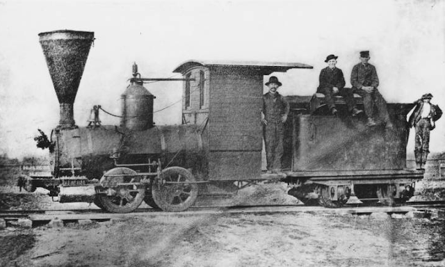
The Dinkey and its crew north of Boulder Creek, circa 1890. [Courtesy UC Santa Cruz – Colorized using MyHeritage]

The earthquake did increase demand for timber products in San Francisco. Most of the mills on the Dougherty Extension Railroad had closed prior to 1906, but the California Timber Company and F. A. Hihn Company tried to compensate in volume. Activity along the line had reached a new high. Workers roamed the San Lorenzo Valley in search of wood that could be cut into splitstuff, such as fence posts, railroad ties, grape stakes, shingles, and shakes. So many of these had piled up along the extension line that the California Timber Company’s foreman estimated it would take more than 120 days of continuous shipping to remove all of it. Electrical lighting was installed at major landings along the line to enable crews to work day and night. The Sentinel article summarizing this progress named landings at Whitener’s and Keefe’s, two places hitherto unmentioned as stops in sources. The former referred to John D. Whitener, a local property investor who was noted in 1912 as the owner of a mill in Boulder Creek. The latter was named after Garrett Keefe, a mill worker with a property near Dougherty’s. His daughter, Mamie S. Keefe, served as the teacher at Dougherty’s School in 1906. Neither location is mentioned as a landing after July 1907.

The Dinkey and South Pacific Coast locomotive no. 23 at Boulder Creek, circa 1900 [Courtesy Phil Reader – Colorized using MyHeritage]

The Coast Line Railway never made it past Davenport and the Ocean Shore Railroad never reached Pescadero. The Mountain Echo reported a rumor in August 1907 that Southern Pacific still planned to construct a line to Pescadero, with a second extension to Congress Springs near Saratoga, both of which would require long and expensive tunnels. It also speculated that the line would be standard-gauged to at least King’s Creek. None of this came to pass. By 1910, the prospect of the Dougherty Extension Railroad being taken over by either firm seemed unlikely. Henry Middleton and his allies reluctantly began harvesting new timber tracts on Pescadero and Butano Creeks in June under the name Western Shore Lumber Company. They held out hope that Southern Pacific would see the potential profit and extend the Dougherty line. Again in February 1912, a rumor circulated that Southern Pacific planned to build a new line to Congress Springs via King’s Creek, with all of the right-of-way allegedly already acquired. Such a line could have reduced the distance between San Francisco and Santa Cruz by up to 10 miles and put all of the major population centers in the San Lorenzo Valley on a mainline. Even as late as February 1916, the Santa Cruz Evening News speculated that a new lumber combine planned to buy all the available timber tracts on Pescadero Creek, standard gauge the Dougherty Extension Railroad, and extend it to the headwaters of Pescadero Creek. Shifting global demands caused by World War I likely shelved these plans.

Motor car on the tracks at Wildwood, circa 1914. [Courtesy Derek R. Whaley – Colorized using MyHeritage]

An entirely different venture emerged along the line in April 1909. The American Real Estate Company, a San Francisco firm, was contracted by W. H. Booth to subdivide and sell his property located directly north of the Cunningham & Company’s former mill. The company hoped to build a seasonal village there named Wildwood, populated by Bay Area elite. And what better way to convey people two miles north of Boulder Creek than with a scenic railroad? Henry Middleton allowed the company to borrow the Dinkey and its crew to shuttle potential property owners to the site. A flatcar was refitted with bench seats, painted, and decorated to advertise the subdivision. And because this section of track had been constructed to the standards of the Southern Pacific, it was a smooth ride the whole way. Promotional excursions began running on May 19, 1909, and continued through the next five summers. In 1914, the Dinkey was replaced by a gas-powered motorcar that could hold eight passengers and the driver. Its speed and operational cost made it much cheaper to operate than the 40-year-old locomotive. Properties sold by the dozens, but with the increase in automobile travel and the cost of maintaining the railroad line, the owners decided not to continue its use after the 1914 season.

Campers and real estate speculators at Wildwood, circa 1913. [Courtesy Derek R. Whaley – Colorized using MyHeritage]

The end of promotional excursions loosely coincided with the end of logging operations on Pescadero Creek. The California Timber Company’s property was hit with a massive wildfire in September 1913 and much of its unharvested timber burned. This likely led the firm to abandon its mill and end operations in the area, though it may have been planning to close at the end of the season anyway. Earlier that year, in March, the Santa Clara Valley Mill & Lumber Company sold its properties, including the Dougherty Extension Railroad, to the newly-formed Santa Cruz Mountain Land Company, run by San Mateo and San Francisco investors. The new owners allowed the logging and Wildwood trains to run through the 1913 and 1914 seasons, but all activity appears to have ceased afterwards. The track sat idle for around three years. On April 4, 1917, the rails were allegedly sold to H. Stroll for $700, with the condition that the land company had to remove them. It did not and Stroll sued in November 1918 for failure to fulfill the contract. The amount of the suit suggests that Stroll removed the rails himself at a cost of $5,000, from which he deducted the amount he paid for them. The suit continued into 1919 with the defendant claiming a demurrer. The result was that the Dougherty Extension Railroad was dismantled and its rails scrapped.

A section of surviving right-of-way near the junction Saratoga Toll Road and State Route 9, 2013. Photo by Derek Whaley. [Courtesy Derek R. Whaley]

A surprising amount of the Dougherty Extension Railroad’s right-of-way survives intact today. For the first two miles, the right-of-way mostly sits comfortably between State Route 9 and the river, where one may catch glimpses of it at times, although there are many homes now built atop the former right-of-way. At Wildwood, the route continues along River Road, eventually crossing through Camp Campbell and Camp Harmon. From Teilh Drive, it once again sits between Highway 9 and the river until reaching Fern Drive. The route crosses the river at roughly the same spot as the Fern Drive bridge, and the right-of-way continues north along the west bank from this point onward. Just before the start of the Saratoga Toll Road, traces of the right-of-way can be seen on either side of the road, with some original ties remaining in place. To the south from here, the right-of-way passes through a shallow cut and continues for roughly 0.5 miles within Castle Rock State Park before reaching private property. To the north, the route continues along the eastern side of the former toll road and has become overgrown and difficult to navigate, with an abundance of poison oak. The right-of-way suddenly vanishes just beyond a bend in the San Lorenzo River about 0.4 miles south of the confluence of Tin Can Creek.

Citations & Credits:

  • Coast Line Railway Company. “Articles of Incorporation." April 12, 1905. California State Archives.
  • Hamman. Rick. California Central Coast Railways, second edition. Santa Cruz, CA: Otter B Books, 2002.
  • History of Monterey and Santa Cruz Counties, California: Cradle of California’s History and Romance, Vol. II. Chicago: S. J. Clarke Publishing, 1925.
  • “Official Map of the County of Santa Cruz.” San Francisco, CA: Punnett Brothers, 1906.
  • Redwood City Democrat. April 6, 1905. Page 3:7.
  • Sanborn–Perris Map Company. “Boulder Creek, Santa Cruz Co., Cal.” June 1897.
  • Santa Cruz Daily Sentinel, Evening Sentinel, and Morning Sentinel. 1886–1913.
  • Santa Cruz Evening News. 1907–1916.
  • Santa Cruz Surf. 1888–1903.

Thursday, March 10, 2022

Companies: Molino Timber Company

Now you can hear it!
Or watch it!

Rancho Soquel Augmentation still had thousands of acres of unharvested old growth redwood trees in the spring of 1910. Yet the Loma Prieta Lumber Company, which owned the land, had spent the better part of the past decade failing to harvest anything other than the most accessible acreage. Conservative in its outlook and methods, the company hesitated when it should have asserted. By 1910, it had abandoned operations in Hinckley Gulch and its small mill on Mill Creek north of Davenport was quickly running out of usable timber. If the company was to remain viable going forward, it needed help.

The Molino Timber Company's locomotive backing a train of empty wagons into the forest above Hinckley Gulch, 1910s. [Woods Mattingly Collection, Aptos Museum – colorized using DeOldify]

Assistance came from Alfred Williams, Oscar E. Chase, Albretto "Bert" Stoodley, Fred Daubenbiss, and Fred Severance, who on May 31, 1910 joined forces to incorporate the Molino Timber Company. All of the men were employees of the Loma Prieta Lumber Company and retained their positions within the firm. The stated goal of the new company was to harvest difficult-to-access timber on behalf of the Loma Prieta Lumber Company so that the latter could eventually plant eucalyptus trees throughout its properties within the Augmentation. What the directors lacked in money they made up for in ambition and vision. Their first task was to send crews along Aptos Creek to chop up abandoned and overlooked trees for firewood. This would generate some initial revenue from which they could further invest in equipment. Then, in late 1910, the company was made a subsidiary of the Loma Prieta Lumber Company and given the contract for harvesting the remaining timber in Hinckley Gulch.

The flooded remains of the Loma Prieta Lumber Company's Hinckley Gulch mill following the 1906 San Francisco Earthquake. [Aptos Museum – colorized using DeOldify]

This narrow, remote tributary of the East Branch of Soquel Creek had eluded thorough timber harvesting since 1901. The canyon was difficult to access and vulnerable to natural disasters such as flooding, landslides, and earthquakes. On April 18, 1906, several lumbermen and a Chinese cook were killed in a massive landslide triggered by the San Francisco Earthquake. The Loma Prieta Lumber Company never recovered from this loss and eventually gave up on the gulch and its millions of board feet of timber. But the Molino Timber Company had some ideas that were more risky and the Loma Prieta Lumber Company was keen to make money.

Narrow-gauge tracks on the old Loma Prieta Branch right-of-way, 1910s.  [Woods Mattingly Collection, Aptos Museum – colorized using DeOldify]

The Molino directors reasoned that the only way to profitably extract the timber was via a railroad. But the Loma Prieta Branch of the Southern Pacific Railroad had recently been cut back to the old village of Loma Prieta, far south of where any line to Hinckley Gulch would need to be located. Meanwhile, a route up Bridge Creek could potentially get to Hinckley Gulch, but at too high of an elevation to be useful. The conclusion the directors of the company came to was that any useful railroad would have to run along China Ridge, which was substantially higher in elevation than the current railroad grade. A 30-inch narrow-gauge railroad was the only affordable option and, in any case, would allow trains to make very sharp turns and pass through very narrow cuts. A switchback, meanwhile, could get the train to the top of the ridge. Unfortunately, over three miles of track would be needed to achieve this goal. In addition, another three miles would be needed to reach Hinckley Gulch, and four more miles to reach the heart of the the timberland. This was simply not practical.

The bottom of the Molino incline, 1910s. [The Forest of Nisene Marks State Park Collection, Aptos Museum – colorized using DeOldify]

After much debate, the directors finally agreed on building a 2,250-foot-long, steam-powered cable incline. It wasn't the first in the county—a similar incline had run at Waterman Switch north of Boulder Creek, but that operation did not have a railroad running within Waterman Gap. This incline would serve as the midpoint of a timber-cutting network that would operate in two sections, one at the top of China Ridge using a small 10.5-ton Shay locomotive, and one along Aptos Creek using first a modified gas-powered Maxwell automobile and later a Scott-Hall gasoline rail speeder. The product brought out of Hinckley would not be logs, but rather splitstuff such as railroad crossties, grape stakes, fence posts, and shingle and shake bolts. This would keep the carloads light and obviate the need for ballast. The splitstuff would be hauled to the railroad grade either on pack mules or via highlines, where it would be loaded into waiting wagons.

Piles of splitstuff lining the dual-gauge tracks at Molino Junction, 1910s. [Woods Mattingly Collection, Aptos Museum – colorized using DeOldify]

Splitstuff was also quick to produce. As a result, the railroad tracks from Loma Prieta to the southern boundary of the Augmentation were lined with stacks of splitstuff awaiting pickup by Southern Pacific trains. Even before the railroad was completed, the F. A. Hihn Company hired the Molino Timber Company to haul out splitstuff from its logging operation at the headwaters of Bridge Creek. Stacks of its splitstuff were placed side-by-side with Molino stacks, with the incline being used to haul both down to the Aptos Creek grade. It was the duty of the lumberjacks to keep straight which piles of splitstuff were Molino's and which were Hihn's.

The Molino train passing beside a water tower along the Molino grade, 1910s. [The Forest of Nisene Marks State Park Collection, Aptos Museum – colorized using DeOldify]

Construction of the line began in spring 1912. Southern Pacific readily agreed to allow a third rail to be added to its tracks between the end of the Loma Prieta Branch at the village of Loma Prieta and the former Schilling's Camp (today's Porter Picnic Area in The Forest of Nisene Marks State Park). For the first time, the private switch at Molino, which had initially split off for the Molino shingle mill in 1884 and later for the main Loma Prieta mill from 1886, was upgraded to a formal stop by Southern Pacific. A former county engineer, Arnold Baldwin, was hired to build the line. Around 100 workers were employed that summer, half to build the railroad and the other half to cut splitstuff in the forest.

Molino workers posing for the camera at Camp No. 1, with the incline's cable hoist and the top of the incline in the center, 1910s. [Aptos Museum – colorized using DeOldify]

The Molino Timber Company's operation eventually had three camps and a waypoint along China Ridge. Camp No. 1 was at the top of the incline and included the massive donkey engine that operated the cable hoist, locomotive storage and repair facilities, homes for the hoist operators and mechanics, sidings for spare and under-repair rolling stock, a water tower and wood bunker to resupply the locomotive, a blacksmith shop, and other facilities for the small group of people that lived there. After 1912, no logging took place in the vicinity of Camp No. 1 and it only hosted a small population of workers.

Probably the F. A. Hihn Company's splitstuff camp at the headwaters of Bridge Creek below Sand Point, 1910s. [Woods Mattingly Collection, Aptos Museum – colorized using DeOldify]

In 1913, railroad construction crews reached Sand Point 3.5 miles beyond Camp No. 1, where Hinckley and China Ridges meet. It was here that the F. A. Hihn Company's splitstuff from the headwaters of Bridge Creek was hoisted up via highlines to the railroad grade for transfer to the incline and beyond. To support this effort, the location had at least two sidings to allow the loading of rolling stock. To reach Sand Point, ten bridges and numerous half-bridges were needed to cross all the gullies above Bridge Creek. These were crude structures made of stacks of logs and splitstuff and held together with the same. Unlike the Loma Prieta Branch, which was built to Southern Pacific standards, this route was a remote logging railroad and the Molino Timber Company cut costs wherever possible. The one-mile route from Sand Point to Camp No. 2 was even more rugged, crossing over several deep gullies via six more bridges.

Camp No. 2 on the slopes of Santa Rosalia Ridge, ca 1915. [Aptos Museum – colorized using DeOldify]

It was at Camp No. 2, reached in late 1913, that the majority of the workers lived in crudely-built shacks atop the adjacent hill. The place had the unfortunate monicker of "Jap Camp" due to the high number of Japanese lumbermen who worked here during the high season. The camp had many worker cabins and a dormitory, a cookhouse, and small amenities to keep the men occupied in the evenings. Around 70 workers lived in the forest during the harvest season, with some chopping trees, some stripping them, others cutting them and preparing them for transport. At the end of the day, most returned to Camp No. 2 except for the most hardy cruisers, who ranged deep into the forest to identify potentially profitable groves. The railroad built two spurs at the camp to park rolling stock. A switchback to the top of the ridge was also built to more easily access timber near the summit.

Workers posing with a wagon on a trestle bridge along the Molino grade, 1910s.  [Woods Mattingly Collection, Aptos Museum – colorized using DeOldify]

The majority of the Molino Timber Company's logging operations were centered at Camp No. 2. Work crews took pack mules down into the gullies of Hinckley Gulch each day and returned in the evenings. Most splitstuff was cut on site and brought up to the railroad grade either by mule or via highlines that were suspended across the entire gulch, which spanned a mile from ridge-to-ridge. Larger logs were also sometimes hauled to the camp, where they were processed on site rather than in the gulch due to poor terrain for cutting. Most piecemakers—splitstuff cutters—worked by themselves or in tandem, and the Japanese workers in particular did not like working with each other. The railroad would make two to three runs on most days, hauling four to six cars per run. This system worked from late 1913 through mid-1916, when most of the available timber around Camp No. 2 was exhausted.

A wagon passing through a narrow cut along the Molino grade, 1910s. [Woods Mattingly Collection, Aptos Museum – colorized using DeOldify]

Beginning in late 1915, the railroad line was extended deeper into the forest toward the headwaters of Hinckley Gulch, but it did not reach Camp No. 3 until mid-1916. Part of the reason for this slow progress was the extreme terrain, which involved deep gullies, narrow cuts, and near-vertical drops. Another sixteen bridges and six deep cuts into the hillside were required to reach Camp No. 3, only two miles away from Camp No. 2. Once the camp was reached and the area prepared, Camp No. 2 shut down and the buildings and machinery were moved north. The large highline donkey engine was also relocated to the camp and work resumed.

Man pulling himself along the mile-long highline cable over Hinckley Gulch, ca 1916. [Woods Mattingly Collection, Aptos Museum – colorized using DeOldify]

In spring 1917, disaster struck the company when the mile-long highline snapped and all attempts at repairing it or replicating it with other lines failed to achieve profitable results. After nearly shutting down the operation permanently, management decided to extend the railroad further to the top of Hinckley Creek. However, it is unclear whether this decision was made by the directors or Timothy Hopkins, president of the Loma Prieta Lumber Company. To reach the new area, the railroad switchbacked twice before finally crossing the creek, where it terminated in two forks on the west bank. The landing here allowed cars to be loaded directly from nearby mule tracks, which reduced crews' reliance on highlines and donkey engines.

Workers posing for the cameraman at Camp No. 3, ca 1917. [Woods Mattingly Collection, Aptos Museum – colorized using DeOldify]

At the end of the 1917 season, all logging at the headwaters of Hinckley Creek ceased. It was a sudden decision sent by Hopkins after the workers had mostly left for the year. Although there was still useable timber in the area, it was deemed too difficult to extract and unlikely to generate sufficient profit. By the late autumn, Hopkins had sent in crews to remove most of the tracks beyond Camp No. 2 in order to use them on a new route the Loma Prieta Lumber Company was building along Bridge Creek. The track that remained continued to be used to remove splitstuff from the headwaters of Bridge Creek. It also supported a small group of pieceworkers that returned in spring 1918 to harvest the remaining timber on the slopes of Santa Rosalia Ridge, just to the north of Camp No. 2.

Molino locomotive somewhere along the line, 1910s. [Aptos Museum – colorized using DeOldify]

A disastrous storm in September 1918 severely damaged parts of the new track on Bridge Creek as well as the Molino Timber Company's grade and the tracks at the headwaters of Bridge Creek. The former F. A. Hihn Company's saddleback locomotive Betsy Jane was lost in the mayhem. As a result of the storm, the Loma Prieta Lumber Company salvaged what they could from what was available. The tracks along the ridge were pulled to replace the damaged tracks along the lower portion of Bridge Creek. In spring 1919, the Molino's Shay locomotive and the remaining rolling stock on the ridge were hauled down the incline. Crews then dismantled the remaining track and the incline. Lastly, the massive donkey engine that had run the cable hoist for the past seven years was lowered down to Aptos Creek. On December 1, 1919, the Molino Timber Company was voluntarily dissolved by its directors and all of its remaining assets were transferred to the Loma Prieta Lumber Company.

The Molino shay being lowered down the incline to the grade below, 1919. [Aptos Museum – colorized using DeOldify]

The legacy of the Molino Timber Company's route along China Ridge survives today in the form of the Aptos Creek Fire Road in The Forest of Nisene Marks State Park. After reaching the top of the switchback, hikers and bikers arrive at the site of Camp No. 1, the top of the incline. Continuing down the road, they follow the railroad right-of-way except where it originally deviated over bridges and half-trestles, remains of which can sometimes be found at the bottom of gullies. The Sand Point Overlook marks the start of the Hinckley Basin Fire Road, which once provided logging crews access to the headwaters of Bridge Creek. Continuing on along the main road, the railroad grade eventually veers off to the west while the road continues its climb north up the ridge. This is the site of Camp No. 2 and marked where the railroad first entered Hinckley Gulch. Because of the temporary nature of the camp, nothing survives today except the vague trace of a railroad grade disappearing into the forest.

Citations & Credits:

  • Powell, Ronald G. The Shadow of Loma Prieta: Part Three of the History of Rancho Soquel Augmentation. Santa Cruz, CA: Zayante Publishing, forthcoming.

Thursday, December 16, 2021

Railroads: Hihn's Early Railroad Schemes

Railroads did not appear in Santa Cruz County overnight. Between the first whisper of a local railroad published in the Santa Cruz Sentinel in December 1862 and the completion of the county's first railroad in October 1875, several plans were made and companies incorporated to build a railroad somewhere within the county. Without question, the most enthusiastic promotor of local railroad schemes was Frederick A. Hihn, whose wealth, vast land holdings, political influence, and general popularity afforded him much leverage in pursuing his grand vision for the county. Following a brief debate published in the Sentinel over several weeks in January 1866, Hihn pushed forward with his plan to build a standard-gauge railroad that would connect Santa Cruz County to the San Francisco & San José Railroad, which had opened January 16, 1864. Surveys were undertaken and public forums were held to compare the merits of a route to San Francisco via the San Lorenzo Valley—promoted by "Sayante" (probably Thomas S. Farmer)—versus a route along the coast and up the Pajaro Valley to San José. It took over a year for two rival companies to materialize. The San Lorenzo Railroad formed first on June 20, 1867. Two days later, on June 22, Hihn incorporated his own company with the aim of linking Watsonville to San José via Gilroy.

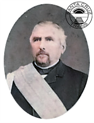
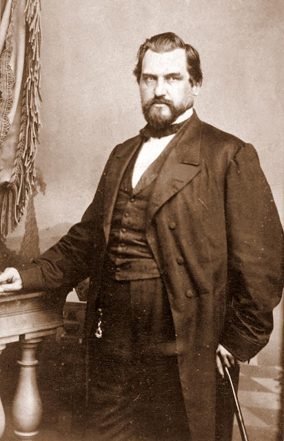
Frederick A. Hihn wearing a Society of California Pioneers sash, 1880s. [University of California, Santa Cruz — colorized using DeOldify]

California Coast Railroad Company (1867 – 1870)

The California Coast Railroad was financed by a great many members of Watsonville and Pajaro Valley society, including Nathaniel Chittenden, Charles Ford, Lucian Sanborn, and James Sargent. It was a bold but plausible plan with a moving target that hoped to connect with the nascent Southern Pacific Railroad wherever it was convenient. At the time, the exact plans for the Southern Pacific Railroad were unclear except that it hoped to construct a railroad south from San José through Gilroy. Two options from there were to continue down the San Benito Valley and cross into the San Joaquín Valley at the first opportunity. Alternatively, the route could turn down the Pajaro River and continue south via the Salinas River. Most surveyors at the time favored the former option, and indeed the Southern Pacific Railroad did initially attempt that before changing its mind and taking the Pajaro Valley route. In any case, that was in the future. Hihn and his colleagues wanted to ensure that they got their connection regardless of Southern Pacific's eventual decision.

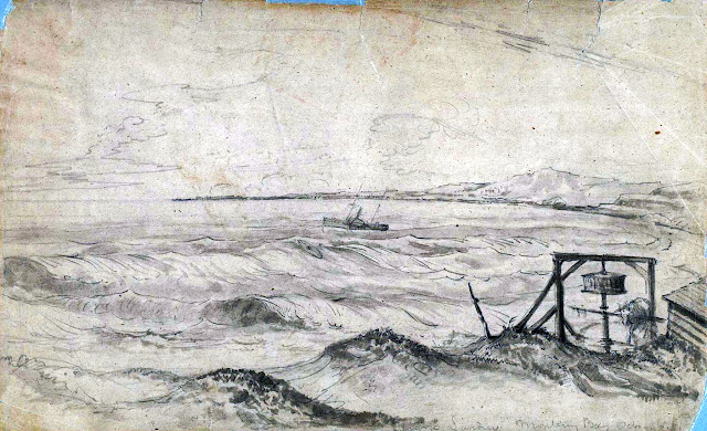
Sketch of Pajaro Landing, October 1856, by William Birch McMurtrie. [Bancroft]

Surveys were conducted throughout late 1867 but little more progress was made and subscriptions were not actively solicited outside the initial backers. However, once construction of the Santa Clara & Pajaro Valley Railroad between San José and Gilroy began in February 1868, Hihn began selling stocks as widely as he could reasonably advertise them. His plan did not go as well as he had hoped. Trying to gather funds from the initial contributors was difficult enough, and the Pajaro Valley was not yet populated or wealthy enough to attract as heavy of an investment as was required. The stated capital stock was listed at the astronomical amount of $400,000 for only about 20 miles of relatively level track. Thus, the project languished even as the railroad to Gilroy was completed on April 10, 1869.

A gathering of the Society of California Pioneers on Admission Day, 1880s. [Santa Cruz Public Libraries – colorized using DeOldify]

Unperturbed, Hihn included the railroad into his autumn 1869 campaign for a seat in the California State Assembly. After winning the election, Hihn held several controversial and contentious public meetings. The result was a bill that would allow public funds to finance $8,000 per mile of the route, as well as branch lines up the San Lorenzo Valley (via the existing San Lorenzo Railroad Company) and Soquel Creek. Late during the drafting stage, the Southern Pacific Railroad incorporated the California Southern Railroad Company on January 22, 1870. This new railroad intended to build a route between Gilroy and Salinas and beyond—a total proposed length of 250 miles. In other words, it would follow the already-proposed route of the California Coast Railroad, and nobody in Santa Cruz County would have to finance it. As a result, Hihn inserted the California Southern into his railroad bill on March 5, 1870, and the California Coast Railroad was promptly forgotten.

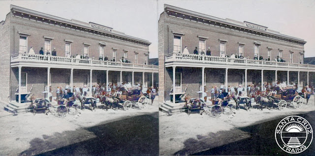
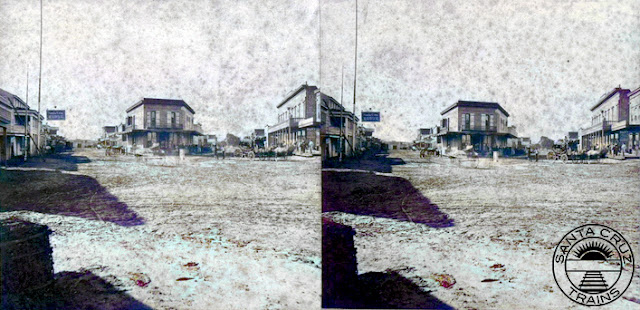
Stereograph of the Pacific Ocean House, 1866. Photo by Lawrence & Houseworth. [California State Library – colorized using DeOldify]

Despite incorporation and the collapse of the earlier scheme, nothing happened for over a year. Southern Pacific resumed construction of its line south from Gilroy—nominally the Southern Pacific Railroad's mainline—but it stopped just outside Tres Pinos near Hollister. Hihn grew disappointed and began planning again. While his railroad bill had failed due to a veto from the governor, there was still public support for it and his plans. Thus, as his two years in the assembly were coming to an end, Hihn began an ambitious new plan to get the ball rolling once more concerning railroads in Santa Cruz County.

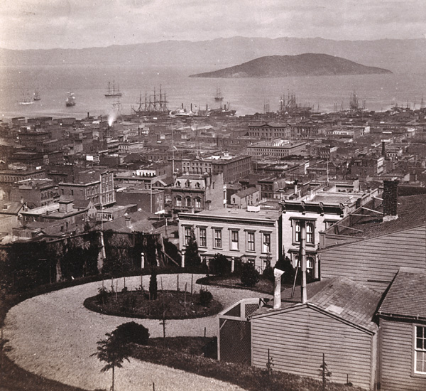
San Francisco from the corner of California and Powell Streets, looking northeast, ca 1870. Photo by Lawrence & Houseworth. [Society of California Pioneers]

Narrow Gauge Railroad Company (1870 – 1872)

Hihn's next scheme was not entirely his own. Part of the reason for the failure of his first plan was its extraordinary cost, which was simply beyond the financial ability of the county. But in 1870, the idea of narrow-gauge railroads invaded the Central Coast and inspired Hihn. With a narrower footprint, lower-grade rails and crossties, and tighter curves, narrow-gauge trains could be built at nearly half the cost of standard-gauge stock. Thus, when the Narrow Gauge Railroad Company was incorporated on November 15, 1870, Hihn made sure that he was one of its directors. The company was led by a British man, L. L. Robinson, and was managed from San Francisco. It had the lofty goal of building a narrow-gauge transcontinental railroad and as such had an initial $1,000,000 capital stock.

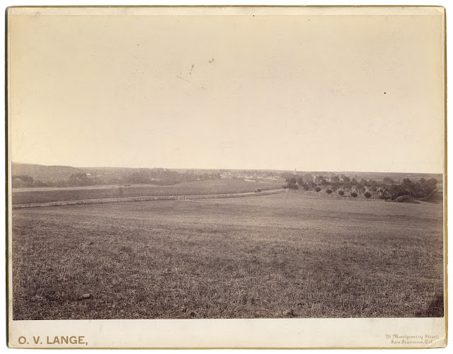
Open fields near Half Moon Bay, 1880s. Photo by O. V. Lange. [California State Library]

The company proposed as its initial route a narrow-gauge railroad down the coast from San Francisco through Santa Cruz County, with the trackage within Santa Cruz County the first to be constructed. However, the railroad was not alone in this goal—on March 23, the Southern Coast Railroad proposed a similar route. A week later, a third railroad, the San Francisco, Santa Cruz and Watsonville Railroad, also incorporated. Comparing all three, they appear to have been completely different firms with the latter two presumably standard gauge. None were promoted by the Southern Pacific Railroad and, notably, none ever succeeded in doing any more than surveying its proposed route. Surveyors for the Narrow Gauge Railroad passed through Santa Cruz County in May 1871 and were never heard from again, the project presumably failing not long afterwards. The only legacy the railroad may have left behind is its survey report, which was likely used by Hihn in later years to help plan the course of his later projects through the county. Undaunted, Hihn moved onto his next plan.

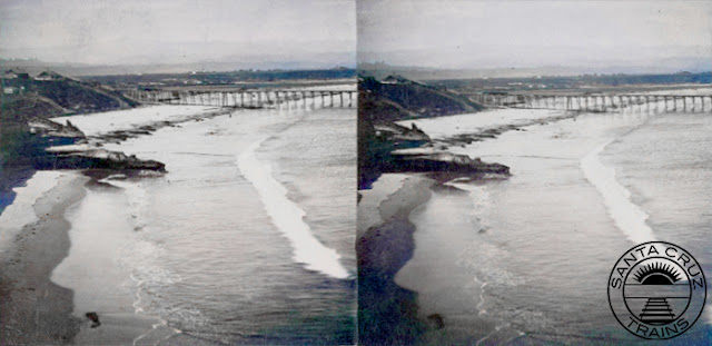
Streograph showing the Santa Cruz Main Beach showing the Powder Works Wharf, 1866. Photo by Lawrence & Houseworth. [California State Library – colorized using DeOldify]

San Lorenzo Valley Railroad Company (1871 – 1874)

Although initially reluctant to support a San Lorenzo Valley railroad scheme, he ended up adding it to his railroad bill in 1869–1870 as a way of drawing more support from the local community. The citizens of Santa Cruz in particular were supportive of it since it meant more revenue would pass through the town. It also would potentially put the Davis & Cowell lime company in its place, since the firm was aggressively blocking several smaller lime companies from getting their products to the wharves at the Santa Cruz Beach. Such was the reason why all progress on the earlier San Lorenzo Railroad had come to a halt. A lawsuit by Davis & Cowell had deprived the railroad of its funding due to legal fees and both firms were fighting a long battle in the courts to determine once and for all whether the railroad company could build a right-of-way through the lime company's lands without their permission.

The flatiron building at the corner of Pacific Avenue and Front Street in Santa Cruz, 1866. Hihn ran all of his later railroad ventures from the second story of this building. [Santa Cruz Public Libraries – colorized using DeOldify]

Hihn waded into this fight assertively while still serving in the state assembly when he incorporated the San Lorenzo Valley Railroad Company on March 11, 1871. It was an opportunistic plan in that it hoped to draw on local demand for the route while inadvertently undermining the efforts of the company that had already formed for the purpose. As expected, the attempt did not succeed. Capitalized at $300,000, the board of directors was composed mostly of San Lorenzo Valley men but only one member of the old firm joined the group. The planned route was almost identical: sixteen miles up from Santa Cruz to Boulder Creek and beyond. The only substantial difference was that Hihn's proposed railroad would be narrow gauge, clearly taking inspiration from his earlier investment.

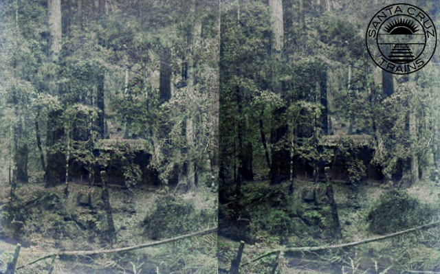
Stereograph of a woodcutter in the Santa Cruz Mountains, ca 1877. Photo by J. D. Strong. [California State Library – colorized using DeOldify]

Just like 1867, when the earlier company was formed, the Sentinel gushed about the plans, acting almost like the previous four years hadn't happened. It speculated that the route would eventually continue across the mountains to some point in the Bay Area. It discussed likely stops in the mountains, how popular the line would be with tourists, and how commuters could make a roundtrip journey to San Francisco in a day. Surveying for the new route began at the end of March 1871, suggesting that the partially-graded line of the San Lorenzo Railroad would not necessarily be used. Indeed, surveyors found a new short-cut under the Hogsback near the California Powder Works that could potentially reduce the route by 1.5 miles. The length of the proposed tunnel—1,100 feet—suggests that the line was still much closer to the San Lorenzo River than the route later taken by the Santa Cruz & Felton Railroad in 1874. The survey was completed at the end of April 1871. Efforts to associate the line with a proposed railroad in San José were ongoing.

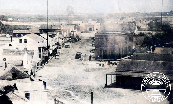
Stereographic view of Santa Cruz, 1866. Photo by Lawrence & Houseworth. [California State Library – colorized using DeOldify]

Speculation continued into 1872 but little more was done. The value of the company's stock remained stable and land speculators began clearing property in Boulder Creek at the proposed terminus of the railroad. Like with the San Lorenzo Railroad three years earlier, the idea of a railroad to Boulder Creek was enough to lead to the town's development. Nonetheless, when the San Lorenzo Railroad lost its case in the California Supreme Court on January 1, 1874, so too died the dreams of the San Lorenzo Valley Railroad. Both schemes were linked to the same idea: that a railroad could be built through Davis & Cowell's lands without its permission and without due compensation. When the case failed, all confidence in such a line collapsed and local investors pulled out. Hihn continued to act as chairman of the board but he may have lost interest in the project as early as August and was certainly looking at other options by early 1872. When the Santa Cruz & Felton Railroad formed in November 1874, it was financed entirely by outside investors who worked with Davis & Cowell to secure a right-of-way to its liking.

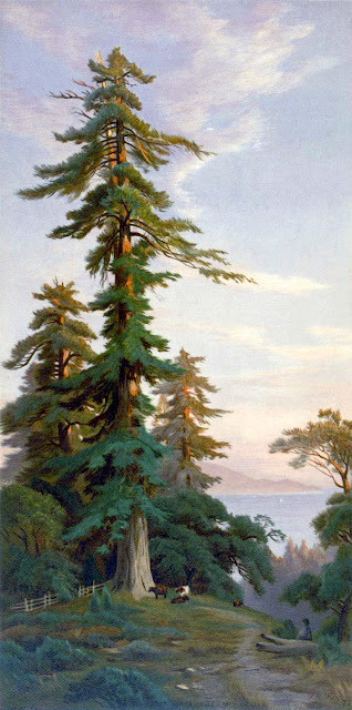
Redwood trees in the Santa Cruz Mountains, ca 1874. Painting by John Ross Key. [Bancroft – colorized using DeOldify]

San Jose & Santa Cruz Railroad Company (1871)

Hihn remained undaunted and began planning his next railroad scheme. Several investors in the Santa Clara Valley had continued to express interest in a route across the mountains and Hihn felt that it was time to push forward a plan he had promoted since September 1869: a railroad up the East Branch of Soquel Creek and down Los Gatos Creek. This route was of personal interest to him since he owned vast tracts of timberland at the headwaters of Soquel Creek and had struggled to economically harvest it since he had acquired it in the mid-1850s. Any route up Soquel Creek would be profitable to him, but he wanted to ensure he had a say in its construction. Thus, after four months of heavy speculation in newspapers and the completion of a survey of the route in May 1871, Hihn incorporated the San Jose & Santa Cruz Railroad Company on July 25, 1871.

Soquel Landing in Capitola, 1870s. [Santa Cruz Public Libraries – colorized using DeOldify]

The proposed narrow-gauge railroad would be 38 miles in length and run from Santa Cruz eastward to Capitola, where it would turn up Soquel Creek and snake along its East Branch until it found a reasonable location for a tunnel under the Summit to the headwaters of Los Gatos, probably near today's Lake Elsman. From there, it would more or less follow the route later built by the South Pacific Coast Railroad in 1878–1880, until the line arrived in San José. Capital stock was set at $500,000 and Hihn was appointed president.

Capitola Beach, ca 1875. Photo by Romanzo E. Wood. [California State University, Chico – colorized using DeOldify]

The nascent route was too little and too late. Indeed, why it was even incorporated is unclear since, on July 17—less than two weeks before—the Southern Pacific Railroad began construction on its long-delayed Watsonville Branch, which would initially extend from Gilroy to Pajaro or Watsonville, and eventually continue to Salinas. This branch line would partially resolve the stated reason for the San Jose & Santa Cruz Railroad since it would finally connect Santa Cruz County to the Santa Clara Valley by rail. While the task of linking Santa Cruz to the Monterey County line was still in the future, part of the decision had been taken away from Hihn and his investors pulled out. The Watsonville Branch was completed to Pajaro on November 26, 1871. Three years later, it was re-designated as the main trunk line of the Northern Division of the Southern Pacific Railroad after the former mainline to Tres Pinos was declared infeasible.

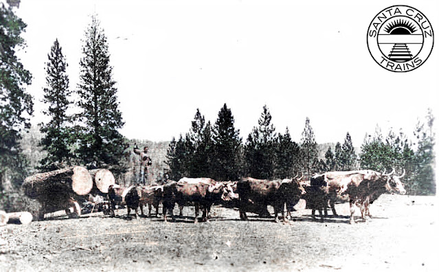
Logging with oxen above Soquel, 1870s. [San Joaquin Valley Library System – colorized using DeOldify]

Hihn's plans for a railroad along Soquel Creek, while possible from an engineering standpoint, was never built. He returned to the idea several times over the years, even reserving in 1889 a right-of-way through large sections of land he owned or purchased that still exists today under the name "Hihn Railroad Grade" on property maps. This route would likely have followed at least part of that surveyed in 1871. Hihn did eventually build a very small stretch of track at Laurel along the West Branch of Soquel Creek, but due to the steep grade from the South Pacific Coast Railway's right-of-way, it was only usable as part of an incline tramway.

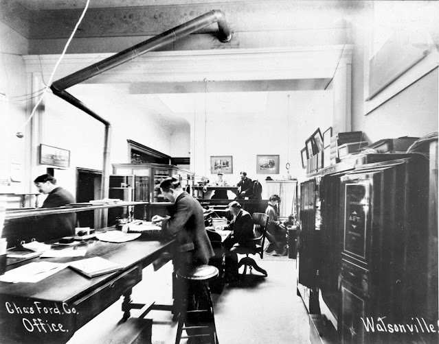
The offices of Charles Ford in Watsonville, 1890. Photo by George Menasco. [Watsonville Public Library]

Santa Cruz & Watsonville Railroad Company (1872 – 1873)

The prospect of a railroad actually reaching Santa Cruz County from San Francisco (via the Santa Clara Valley) excited everyone and Hihn seized the moment once again. Abandoning all of his previous projects, he put his effort into organizing a standard-gauge railroad that could connect Santa Cruz with the Southern Pacific tracks at Pajaro. In mid-December 1871, a ballot measure passed by a heavy margin granting a subsidy to build a railroad between the two points. Only Watsonville residents resisted the measure because they already considered themselves connected to the Southern Pacific network and saw little advantage in supporting a railroad to Santa Cruz. Following a month of discussion and planning, on January 18, 1872, the Santa Cruz & Watsonville Railroad Company was incorporated.

Stereograph of the intersection of Front Street and Pacific Avenue in Santa Cruz, with Hihn's flatiron building in the center, 1866. Photo by Lawrence & Houseworth. [California State Library – colorized using DeOldify]

The length of the route was set at 20 miles with it expected to follow the coastline closely. As with the previous two projects, Hihn was made president alongside several other local Santa Cruz entrepreneurs who had supported Hihn's previous schemes. Capital stock was set at the still optimistic $500,000, of which $100,000 was promised by the county at a rate of $5,000 per mile built. The county required construction to begin within six months and the entire line had to be completed by January 1874. On paper, everything seemed reasonable. Surveyors began their surveying and board members began soliciting subscribers.

Portrait of Leland Stanford, 1870s. [Bancroft]

It was in early April that Hihn made a fatal mistake. He met with Leland Stanford of the Southern Pacific Railroad in San Francisco, and during the meeting Stanford promised to conduct a survey in anticipation of taking over construction of the Santa Cruz & Watsonville Railroad. With such an important financier on board, the subscription drive collapsed. Why have locals pay for what the Southern Pacific would do itself? To complicate matters further, the Atlantic & Pacific Railroad sent surveyors into Santa Cruz County in June 1872 shortly after the incorporation of its subsidiary San Francisco & Atlantic Railroad. The company hoped to build a transcontinental route from San Francisco, from where it would follow the coast to Los Angeles before turning east to the Colorado River. That meant that two companies wanted to build standard-gauge railroads that would connect Santa Cruz to Watsonville—one by taking over the existing company, the other via an entirely new company with a grander vision. Both options seemed better than funding a railroad entirely on local funds and subscriptions.

Streographic view of Santa Cruz from High Street, 1866. Photo by Lawrence & Houseworth [California State Library – colorized using DeOldify]

And so ended Hihn's penultimate attempt to build a railroad. The public was distracted and in the summer of 1872, they felt confident that somebody else would solve their railroad problem for them. But they were wrong. By early September, it was clear that the Southern Pacific had both blocked the Atlantic & Pacific's plans in the Bay Area and reneged on its agreement with Hihn to take over the Santa Cruz & Watsonville Railroad. Faced with high costs and few funds, Hihn pitched the idea of a 40-mile-long narrow-gauge railroad between the San Mateo County line and Pajaro, thereby leaving open the possibility of a future take-over of the route. In late November, Hihn convinced a joint Santa Cruz–San Mateo County railroad committee to agreeing in principal to funding the line at a cost of $250,000.

The Santa Cruz Railroad's Betsy Jane with its crew, ca 1875. [University of Southern California]

An annoying delay caused by yet another appearance by Stanford in late January 1873 led to more empty promises, but this time Hihn was prepared. He asked for a show of good faith. Stanford surprisingly delivered and brought in surveying crews to map the entire proposed route to Santa Cruz. However, financial instability began rolling out of Europe in the summer of 1873 and the Southern Pacific Railroad was forced to pull out of its expansion plans throughout the state. Hihn pushed on and began gathering subscriptions. On August 4, 1873, he and a small group of associates incorporated the narrow-gauge Santa Cruz Railroad Company. This time, his scheme finally bore fruit and Santa Cruz entered the age of the iron horse. The rest is history.

Citations & Credits: