Showing posts with label South Pacific Coast Railroad. Show all posts

Thursday, April 13, 2023

Events: The Train Wreck of May 23, 1880

While train rides in the Santa Cruz Mountains were sometimes fun affairs and more usually just a part of a person’s daily commute, in the afternoon of Sunday, May 23, 1880, an excursion trip became the stuff of nightmares. That morning, a fourteen-car South Pacific Coast Railroad excursion train arrived at Big Trees, today's Henry Cowell Redwoods State Park. In it were members of the San Francisco Bohemian Club, the Alameda Harmonie Verein, and the Independent Rifles, among others, about 300 people in total. Picnickers enjoyed the early afternoon walking through the redwood groves and picking wild flowers. Some fished while others just relaxed under the mid-Spring sun. A number of Santa Cruzans had travelled to Felton earlier in the day to join the excursion group. Included among these were Duncan McPherson, editor of the Santa Cruz Sentinel, and Santa Cruz County Sheriff Elmer Dakan.

Original chromolithograph of the May 23, 1880 wreck commissioned by and published in The San Francisco Illustrated Wasp on June 5. Art by Mr. Keller.

At around 3:00 p.m., Felton Depot received a request from a group of excursionists for a train to take them to Santa Cruz, where they hoped to enjoy the last hours of the day at the beach. The train of George L. Colegrove, a man experienced with the route through San Lorenzo Gorge, was initially assigned the duty, but this was rescinded and a different crew was tasked with the duty headed by engineer Robert J. Elliott and his fireman, Frank R. Thompson, neither of whom had ever taken the train down the grade. Elliott's train was larger than Colegrove's, which meant that it had to be controlled with more caution as it navigated San Lorenzo Gorge. Colegrove quickly coached Elliott about the dangers of the route, and provided him with his brakeman, Howard D. Anthrum, who knew the line well. Sam Davis, the younger brother of the railroad’s president, Alfred Davis, also insisted on joining the crew in the cab of South Pacific Coast Railroad Locomotive No. 3. Other crew members included Alfred Withers, an attaché of the railroad, and M. D. McLean, the brakeman.

Early view of Big Trees before the addition of a siding for passenger cars, 1880s. Photo by Alfred J. Perkins. [WorthPoint – colorized using MyHeritage]

Rather than use formal passenger cars, Elliott chose to bring flatcars that had bench seats and four-foot guard rails installed, similar in style to the Santa Cruz Big Trees & Pacific Railway excursion cars uses today, though more crudely constructed. Elliott’s train arrived at Big Trees at around 3:15 and the engineer sounded the whistle for all aboard. Conductor William D. Bones crowded the picnickers onto three of the open-air excursion cars, which only measured 24 feet in length. By the time the train was ready to go ten minutes later, many passengers were standing precariously or shoved against the poor-quality railings of the cars. For whatever reason, Elliott had decided against turning the locomotive at the Felton turntable and instead planned to back the train down the seven miles of track through San Lorenzo Gorge to Santa Cruz.

The area known as Summit, later Rincon, with a South Pacific Coast Railway train approaching on the main line, ca 1900. [UC Santa Cruz Digital Collections – colorized using MyHeritage]

Three miles along the route, at around 4:00, the train reached Summit, the highest point along the line. The three miles beyond Summit were steep with tight turns, precarious bridges, and a tunnel through the Hogsback above the California Powder Works. Elliott and his crew, looking over the tender of their locomotive, began to back down the grade from Summit and passed into Tunnel No. 7. It was here that all accounts agree things began to go wrong. The train began to gain speed as it curved out of the tunnel toward the grade crossing of West San Lorenzo Drive (Highway 9). Elliott blew the whistle alerting Bones and McLean to begin braking the cars. McLean later claimed that he had already tightened the brakes on the first car, but Bones admitted that he could not get to the brake wheel on the third car because it was overloaded with passengers and he was busy collecting money.

The sharp curve on the railroad tracks at the West San Lorenzo Drive grade crossing, May 24, 1880. [Alan Young – colorized using MyHeritage]

Elliott looked through the cab window toward the back of the train and watched as the three flatcars began swaying heavily. He slammed on the engine’s brakes and put the drive wheels of the locomotive in reverse, but this did little to slow the train. A minor buckle in the track, probably caused by heat expansion from the unusually warm Spring day, caused the locomotive to rock severely and lift off the outside rails as the train curved around a tight bend. Centrifugal force pulled the passengers toward the hillside, adding a heavy weight to a poorly-built railing. The railing gave way in the second car when it brushed against a rock outcropping. As the car derailed, passengers began spilling into the hillside and onto the tracks below. The third car also derailed, falling down the opposite embankment toward the road below. More passengers were dumped over the side of the car. Elliott braked as hard as he was able from the front of the train and it slowly rolled to a stop just before the bridge over Shady Gulch. But it was too late.

The deadly rock outcropping where the car derailed, crushing passengers into the hillside, May 24, 1880. [Alan Young – colorized using MyHeritage]

Scattered across the rails were bodies everywhere. Nearly sixty passengers from the two cars were littered across the tracks. Those from the third car were thrown down the hill, where many of them were badly injured but most survived. The passengers from the second car, though, were less lucky. Dashed against the hillside, many were crushed or, worse, run over by the car that followed. As Elliott, Anthrum, and Davis ran back to the cars, all they heard were screams as the severity of the incident became obvious. It was a massacre. Never in Santa Cruz County history was there such a railroad disaster before or after, and it proved to be the second-worst rail accident in the state to date.

South Pacific Coast Railroad Locomotive No. 3, 1880s. [ebay – colorized using MyHeritage]

Realizing that they could do little to help the people, Elliott and Anthrum uncoupled the locomotive and carefully rode it to Santa Cruz to seek help. They quickly gathered medical supplies, doctors, and others and returned to the site of the accident about thirty minutes later. By this point, thirteen people were declared dead and over fifty other passengers were severely injured. The railroad crew quickly recoupled the cars and put the flatcars back on the track. Those dying or grievously wounded were placed on the cars and rushed to Santa Cruz where they were taken up by most of the local hotels including the Ocean House, Germania Hotel, and Wilkins House. Colegrove’s train was brought in from the north and took less injured people and the remaining excursionists back to Felton, where they were loaded onto a larger train bound for the Bay Area.

South Pacific Coast Railroad Locomotive No. 3 parked at the scene of the wreck for the inquest committee to inspect, May 20, 1880. [Alan Young – colorized using MyHeritage]

Before dusk, two more passengers had died. Two final passengers would die on their journey back to San Francisco, resulting in a total of seventeen dead from the accident. These included Santa Cruzans, San Franciscans, and other men and women of the Bay Area. The full list of deaths included Frank Butler, William Costello, Jeremiah Darcy, Louis Falk, Patrick Gallagher, Frank Herringer, George C. W. Huer, Walter Hoyt, Mrs. C. S. Hussey, Ernest R. Jasper, Clayton F. Merrill, Frederick William Opitz, John Ripon, Joseph Salinger, Henry W. Stahle, and John Straub. The South Pacific Coast Railroad paid for all costs incurred by the passengers due to the accident.

Faced with few options, Dakan arrested Elliott under charges of gross incompetence and manslaughter, although it may also have been for his protection since many of the surviving passengers wished him harm. The sheriff had been on the train in the first car and witnessed the entire affair. While survivors tried to sleep off their injuries and forget the nightmare they had just experienced, crews working for the South Pacific Coast Railroad snuck up to the site of the accident and cleaned up before the full extent of their culpability could be determined.
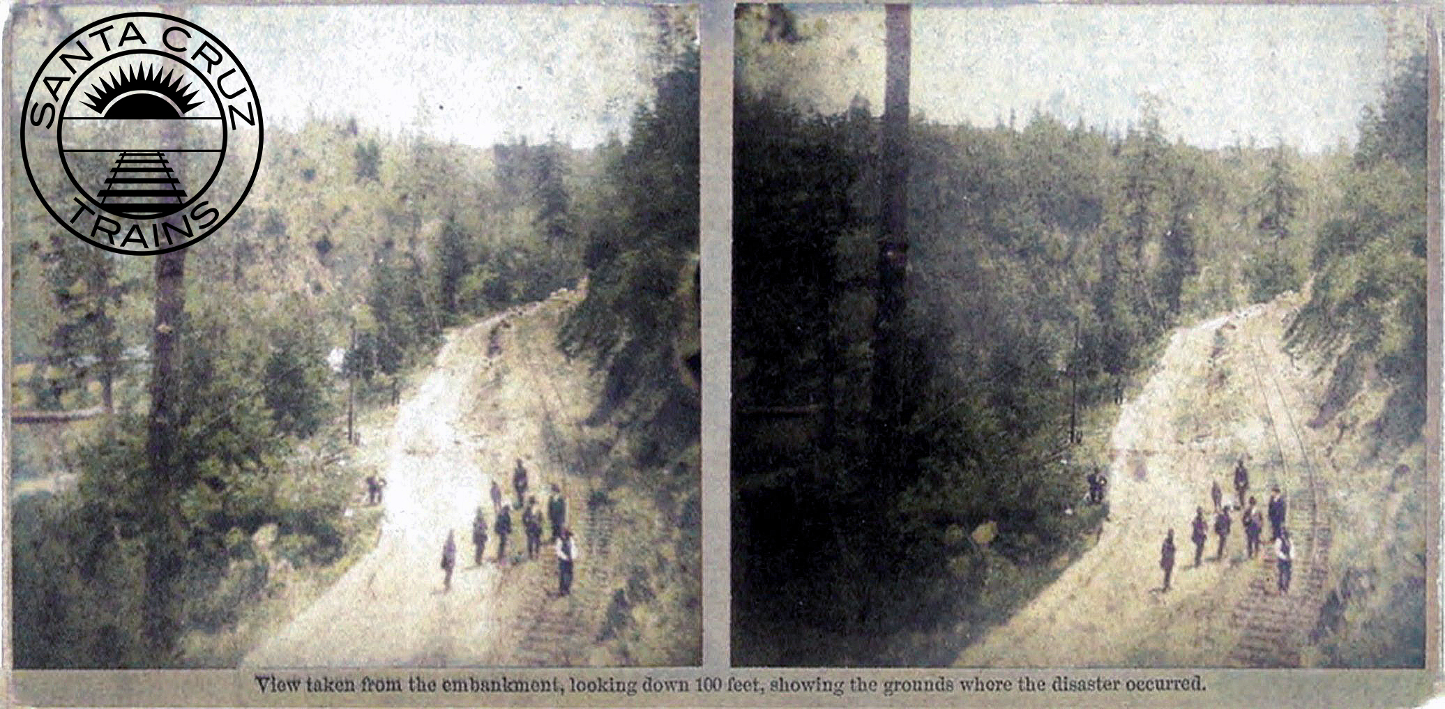
Members of the inquest committee inspecting the tracks, May 24, 1880. [Alan Young – colorized using MyHeritage]

That night, Judge John Pope Davenport ordered the coroner’s inquest board to investigate the incident. Early the next morning, the nine-member board headed out to the site of the accident. They found to their annoyance that the entire site had been stripped of evidence, with the flatcars gone, the rails and ties repaired, and the grade raised and freshly ballasted. Almost all evidence of the accident had been erased. While there, a photographer captured at least seven stereographs of the scene, showing where the accident had occurred and several of the surrounding geographic and railroad features. Perhaps surprisingly, these stereographs, with captions explaining their purpose, were sold commercially after first serving as evidence in the inquest.

On Tuesday, May 25, Davenport and the inquest board began to hear testimony from forty witnesses to the event. Elliott’s competence as an engineer was called into question as it was revealed that he had also failed to adequately control the train when he took it from Alameda to Felton on May 22. The poor quality of the couplers used on the train were also noted. Still others emphasized the poorly-ballasted track with rails that had inadequate anchors and joints, all of which may have been further impacted by the unusually hot afternoon on May 23. The board took a week to come to a verdict, presenting a split decision on Monday, May 31.

The inquest committee investigating the site of the wreck, May 24, 1880. [Alan Young – colorized using MyHeritage]

Three members of the board declared the railroad at fault for assigning an inexperienced crew to the train and not properly notifying the engineer of the sharp curves along the route. Another member blamed the engineer for the entire disaster. And the remining five members refused to place blame at all, claiming that accidents happen and the reasons cannot always be known. Besides the railroad’s cover-up efforts, a considerable reason for this split decision was the different stories told by the forty witnesses, few of whom could agree on specifics.

The disaster made worldwide news, with newspapers mentioning it as far away as Australia. An inaccurate color sketch based on initial reports of the accident was produced by Mr. Keller for the June 5 issue of The San Francisco Illustrated Wasp. Bay Area newspapers continued to report on the coroner’s inquest for the following two weeks. The wreck led to several changes. The South Pacific Coast Railroad began a program of straightening curves and reducing grades across its lines. It also changed the couplers used in its trains and improved its efforts at ballasting track. More importantly, crews operating along the former Santa Cruz & Felton Railroad’s grade had to receive special training and were expected to follow rules closely to ensure that such an incident as that of May 23, 1880 never occurred again.

Citations & Credits:

  • Secrest, William B., Jr., and William B., Sr. California Disasters, 1812–1899: Firsthand accounts of fires, shipwrecks, floods, epidemics, earthquakes and other California tragedies. Sanger, CA: Word Dancer Press, 2006.
  • MacGregor, Bruce. “Stereo Forensics: An Investigation into the May 23, 1880 South Pacific Coast Railroad Accident,” Stereo World 25:5 (Nov/Dec 1998), 10-15.
  • Various newspapers from throughout California and the world, May–June 1880. 

Thursday, September 8, 2022

Curiosities: Travel Times and Speeds

Railroads do not operate in a vacuum—they run according to schedules. For large-scale railroad companies such as Southern Pacific, these are extraordinarily complex schedules that must take into account hundreds of its own trains as well as the schedules of other railroad companies and various bus systems. Thus, it should be unsurprising that railroad timetables, both public and internal-use, are invaluable sources of information to railroad historians. Yet, in the end, the primary purpose of any timetable is to keep a schedule. In fact, the entire standarization of time itself into zones was done for this precise purpose: to make it possible for railroads to run on time. And like all railroads, those that operated in and around the Santa Cruz Mountains ran according to these published schedules.

Men at the ticket window of the Santa Cruz Union Depot, 1911. [University of California, Santa Cruz, Digital Collections – colorized using MyHeritage]

Travel times for regularly-scheduled trains can vary greatly depending on the length of the route, the terrain, the gauge of rail, and the type of train. In the Santa Cruz Mountains, the terrain was a major factor, with many sharp curves and steep grades. Travel speeds through the forest were also often quite slow due to the risk of debris falling on the track that could potentially derail the train. As a result, Southern Pacific passenger train speeds were limited by 1940 to:

• 30 miles per hour between Vasona Junction and Los Gatos
• 20 mph between Los Gatos and Eva
• 25 mph between Eva and Santa Cruz, with a brief 15 mph section between Wright and Glenwood
• 20 mph between Santa Cruz and Davenport
• 30 mph between Santa Cruz and Watsonville Junction (Pajaro)
• 20 mph between Felton and Boulder Creek
• Between 40 and 75 mph (depending on locomotive type) between Gilroy and Watsonville Junction

In the earliest days of travel in Santa Cruz County, most trains ran as mixed, which means they carried both passenger and freight cars. On the other hand, the South Pacific Coast Railroad and the Southern Pacific Railroad both ran dedicated, regularly-scheduled passenger trains from the early 1880s. They did continue to operate mixed trains, but many of their trains were either regular or express passenger trains. Regular trains could stop at any registered station or flag-stop, as well as various recognized but unrecorded stops. These are, therefore, the slowest trains. Express trains, in contrast, usually only stop at a few locations along a line in order to achieve a faster travel time. Some express trains, such as the Del Monte Limited, Santa Cruz Limited, San Francisco Limited, and the seasonal Sun Tan Special were given names due to their popularity.

Early Santa Cruz County railroads, namely the Santa Cruz Railroad and the Santa Cruz & Felton Railroad, were narrow-gauge and rather crudely-built. This meant that they had slow travel times and often experienced delays or outright cancellations of service due to problems with the line or mechanical failures. When the railroads were operating normally, though, they were much better means of conveyance than the alternative of wagons or walking between destinations.

Santa Cruz Railroad's Santa Cruz depot on Park Street (now Chestnut Street), ca 1880. [Harold van Gorder Collection, Santa Cruz Museum of Art & History – colorized using DeOldify]

Santa Cruz Railroad and Branch

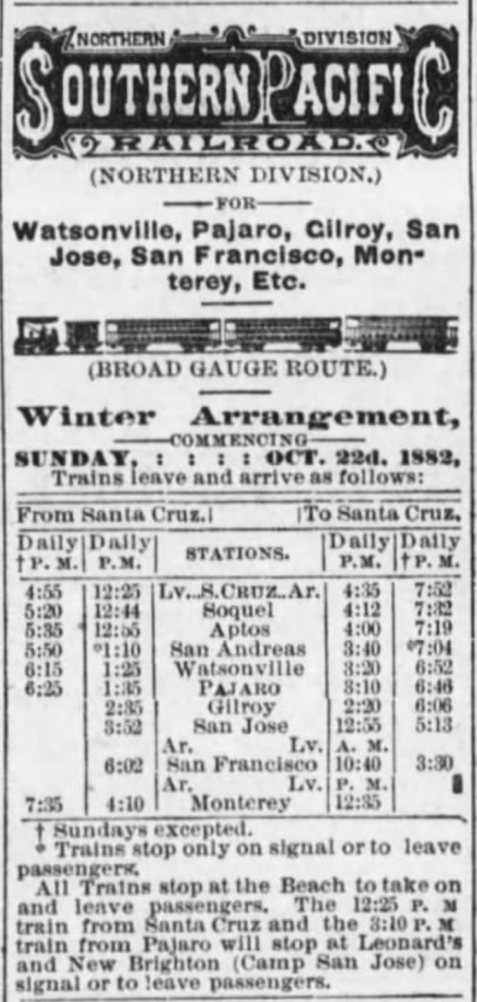
The earliest schedule that exists for a county railroad is that of the Santa Cruz Railroad, published in the Santa Cruz Sentinel on May 15, 1875. At this time, the line was only completed between Santa Cruz (Park Street Station) and Aptos on a journey that took about 50 minutes to cover 8.7 miles of track resulting in a train running at about 10.4 miles per hour. The first full timetable for the 21.5-mile-long Santa Cruz Railroad from Santa Cruz to Pajaro was released on June 10, 1876. At the time, an express train from Santa Cruz to Pajaro took 1 hour, 50 minutes, which translates to an average speed of 11.7 mph. The regular mixed train, in contrast, took 1 hour, 55 minutes, resulting in an average speed of 11.2 mph. Both of these trains were scheduled to meet with Southern Pacific passenger trains travelling along the Coast Division line between San José and Salinas. By 1879, the schedules had become drastically reduced, with the regular having a 1 hour, 45-minutes run and the express 1 hour, 25 minutes, resulting in speeds of 12.3 mph and 15.2 mph respectively.

When Southern Pacific took over in 1881, it immediately set about streamlining the system. The regular passenger train's time was reduced to 1 hour, 40 minutes run, while the express train was reduced to 1 hour, 3 minutes. On the final timetable before the line was standard-gauged in 1883, the time of the regular train was reduced further to 1 hour, 30 minutes, while that of the express increased slightly to 1 hour, 10 minutes. These meant that regular trains were running at 14.3 mph and express at 20.5 mph at the end of the narrow gauge era.

The upgrade to standard gauge tracks made trains larger but slightly safer to operate. Over time, this led to a gradual reduction in travel times across the Santa Cruz Branch. In 1890, regular trains took 1 hour, 25 minutes to travel from Pajaro to Santa Cruz, but express trains could make the distance in only 53 minutes. That resulted in speeds of between 15.2 and 24.3 mph. These were reduced further to 1 hour, 10 minutes for regular trains and 50 minutes for express trains by 1909. The speeds by this time, therefore, reached an average of 18.4 mph and 25.8 mph. These times remained the standard for the next 29 years, until regular passenger service ended along the Santa Cruz Branch.

Southern Pacific Railroad schedule published in the Santa Cruz Sentinel, February 10, 1883.

San Francisco to Santa Cruz via Pajaro

The Santa Cruz Railroad was the first system in the county with the ability to connect to the Southern Pacific Railroad's Coast Division mainline at Pajaro, later Watsonville Junction. Once Southern Pacific took over and upgraded the line, a fluid exchange could happen linking Santa Cruz directly to San Francisco, although in reality there was rarely a through line between the points. Most of the time, passengers had to detrain at Pajaro and board a local train.

Passenger travel between Santa Cruz and San Francisco via the Coast Division mainline was never fast. In 1882, travel between the points—a distance of 121 miles—took around 5 hours, 10 minutes. This meant that the average speed of a journey to san Francisco was 23.4 mph. Around 1890, an express option was added that took just over 4 hours, which averaged 30.1 mph.  Over the next twenty years, the time was cut down further, eventually reaching 3 hours, 35 minutes in 1913. That brought the average speed up to 33.8 mph. From there, though, times increased again since all through traffic to San Francisco was directed north along the former South Pacific Coast route and then via the Los Altos Branch, popularly called the Mayfield Cutoff. By the end of passenger service along the Santa Cruz Branch in 1938, travel time from Santa Cruz to San Francisco via Watsonville Junction was 4 hours, 11 minutes, averaging a speed of 28.9 mph. Sun Tan Specials running from 1940 used this line to bring people to the Santa Cruz Beach and its travel time was 3 hours, 30 minutes, essentially the same as the regular passenger trains of the early 1910s.

Santa Cruz & Felton Railroad Time Table No. 2, from the Sentinel, February 10, 1877.

Santa Cruz & Felton Railroad

In some ways, the Santa Cruz & Felton Railroad was the shortest-lived of all the railroads in the county since it was wholly absorbed into the South Pacific Coast Railroad's mainline system in May 1880. It also did not formally engage in passenger service until several months after it began freight service in late 1875. But during the four years that it operated as a passenger railroad, it had a set scheduled that appeared in the local newspapers. Its No. 2 timetable, published in February 1877, gave travel time between Santa Cruz—then located at the Railroad Wharf—and Felton—near the Mountain Community Resources—as 1 hour exactly. This means that the 7-mile-long route transported passengers at a speed of...7 miles per hour. The Santa Cruz & Felton Railroad offered three runs in each direction. Later in the year, this was reduced to two runs, and in mid-1878 only one run each direction. This remained the status until the South Pacific Coast took over.

Cover of South Pacific Coast Railroad time table no. 3, March 28, 1886.

South Pacific Coast Railroad and Railway

The opening of the South Pacific Coast Railroad to Santa Cruz in 1880 heralded the first (nearly) seamless direct service between San Francisco and Santa Cruz. Nearly because a ferry was still required to transfer passengers from San Francisco to the Alameda Mole near Oakland. The South Pacific Coast was a narrow-gauge railroad that ran directly through the Santa Cruz Mountains, passing through Fremont, San José, Los Gatos, and eight tunnels before reaching the seaside town. Little changed along the line even after Southern Pacific acquired it in 1887, by which point it had reincorporated as the South Pacific Coast Railway. The entire line was not standard-gauged until spring 1909, after which most Santa Cruz–San Francisco traffic went via the Mayfield Cutoff rather than by the original Alameda route.

In the nearly thirty years from 1880, travel times between Alameda Junction and Santa Cruz remained remarkably stable. The speed of the train was always fastest between Alameda and Los Gatos, after which trains encountered a meandering track of steeper grades and sharper curves. Nonetheless, the route as a whole made good time. The April 4, 1881 timetable gave the travel time as 3 hours, 37 minutes, which resulted in an average speed of 20.8 miles per hour across 75.3 miles of trackage. Two years later, the time was reduced to 3 hours, 19 minutes leading to an uptick in the average speed to 23 mph. The timetables soon stabilized for the next decade at the slightly faster time 3 hours, 22 minutes, with trains travelling at an average speed of 22.4 mph. Perhaps due to safety concerns or constant repairs along the line, Southern Pacific eventually moved the time up around 1894 to 3 hours, 30 minutes, averaging 21.5 mph, which it retained until the 1906 San Francisco Earthquake shut down the line and it was standard-gauged.

Passengers boarding a South Pacific Coast Railway train at Ben Lomond, ca 1907. [UCSC Digital Collections – colorized using DeOldify]

Felton & Pescadero Railroad and Boulder Creek Branch

Travel time on the 7.30-mile-long Felton & Pescadero Railroad, a subsidiary of the South Pacific Coast Railroad, varied depending on which direction the train was travelling between Felton and Boulder Creek. If the train was heading north, it took 45 minutes to reach Boulder Creek. If it was heading south, possibly because trains needed to use their brakes more, it took 50 minutes to reach Felton. This meant that trains were travelling 9.7 and 8.8 miles per hour respectively. When Southern Pacific took over the line in 1887, it managed to cut the average travel time down to 33 minutes, which more or less remained standard for the next twenty years. Trains, therefore, could transport passengers between the two termini at a speed of 13.3 mph.

In 1908, when the line shifted to standard gauge, trains were finally able to run at a faster clip. For the first year, trains transported passengers between Felton and Boulder Creek in only 22 minutes! This meant the trains were running at an average speed of 19.9 mph. Clearly this was deemed unsafe, or perhaps the company changed to less efficient locomotives, since in 1909 the time was moved back to 30 minutes. Over two decades, the speed bounced between 25 and 30 minutes for the remainder of its time as a passenger line, which ceased around May 1931. Taking an average travel time of 27.5 minutes, the trains during the final years of the Boulder Creek Branch ran at a speed of 15.9 mph.

Ocean Shore Railway timetable no. 19, July 16, 1911.

Davenport-bound Railroads

Two railroads traversed the northern marine terraces of Santa Cruz County: the Ocean Shore Railway, later Railroad, and the Coast Line Railroad, a subsidiary of Southern Pacific. Both standard-gauge railroads were built at about the same time—between 1905 and 1907—and both had the stated, though unrealized, goal of linking Santa Cruz to San Francisco via a coastal route. The Ocean Shore did make it as far north as Swanton, 15.5 miles from Santa Cruz, but the most important destination along the line was Davenport, at least in the earlier years. This location was 10.8 miles from Santa Cruz on the Ocean Shore Railway, and 11.4 miles on the Coast Line Railroad.

The Ocean Shore's short, fourteen-year existence running passengers along the coast was a relatively consistent affair. All of the company's regular trains were mixed and trains took 28 minutes to run between Santa Cruz and Davenport. This resulted in an average speed of 23.1 miles per hour. The Coast Line, in contrast, began running incredibly slow trains. Initially, mixed trains took up to 1 hour, 15 minutes to transport passengers from Santa Cruz to Davenport, probably due to the number of freight stops trains along the way. So much time resulted in a dismal 9.1 mph speed. This soon picked up, though, and Southern Pacific managed to cut the time to 1 hour in late 1909, allowing trains to run at 11.4 miles per hour. By 1913, enough passenger traffic had picked up that dedicated passenger trains could operate, and these only took 30 minutes, matching the Ocean Shore's travel time and running at a far more comfortable speed of 22.8 mph. Both railroads retained this time for passenger trains until each ceased regular passenger service, in 1920 for the Ocean Shore, and in 1932 for Southern Pacific.

Southern Pacific's morning Santa Cruz express train arriving at San Francisco, August 19, 1937. Photo by Wilbur C. Whittaker [Jim Vail – colorized using DeOldify]

The Mayfield Route

The most efficient service that ever ran between Santa Cruz and San Francisco was the direct trains that Southern Pacific ran along the Los Altos Branch, commonly called the Mayfield Cutoff. What it "cut off" was San José, saving trains a major bottleneck of a station and saving several miles of track miles travelled. The Los Altos Branch, between Vasona Junction and Mayfield near Palo Alto, opened in 1908 and allowed through service from Santa Cruz beginning in mid-1909. The route proved so efficient that the mile markers along the Santa Cruz Branch were actually reversed so that they oriented north through the mountains rather than south toward Pajaro. By 1909, the latter route had been reduced to 120.5 miles between San Francisco and Santa Cruz, while the new Mayfield route was a trifling 79.2 miles.

In the early years of the Mayfield route, trains running between the two termini took 3 hours, 20 minutes to reach their destination. That meant they ran at an impressive average speed of 23.8 miles per hour. As with the South Pacific Coast Railway before it, the speed would have been considerably faster north of Los Gatos and slower through the mountains. In the early 1920s, Southern Pacific managed to shave off nearly half an hour from travel, reducing the time to 2 hours, 52 minutes, resulting in trains running at 27.6 mph. Over the subsequent twenty years, this time only got faster. By February 1940, just prior to the sudden shutdown of the route, regular trains travelling on the Mayfield route could reach San Francisco from Santa Cruz in only 3 hours, 9 minutes at a speed of 26.0 mph. But more incredible was the travel time of express trains, which could make the morning commute in 2 hours, 38 minutes at the then-incredible speed of 30.1 mph.

This was the end of regular or express commuter service in the Santa Cruz Mountains. Except for the occasional excursion train and the seasonal Sun Tan Specials, locals who wished to travel anywhere by train first had to drive or take a bus to Watsonville Junction, Los Gatos, or San José. An era of efficient, comparatively rapid transport had ended.

Citations & Credits:

  • Nanney, Duncan. Personal correspondence.
  • Santa Cruz Sentinel. Various articles, 1875-1940.
  • Southern Pacific Railroad Company, various records. California State Railroad Museum.

Thursday, August 11, 2022

Stations: Eva

One of the primary appeals of a railroad through the Santa Cruz Mountains was its picturesque nature. However, much of the route through which the South Pacific Coast Railroad passed in 1880 was less verdant than it is today. Logging along Los Gatos, Bean, and Zayante Creeks had largely deforested the areas. Nowhere was untouched and only the Welch’s Big Trees Grove near Felton and parts of San Lorenzo Gorge to the south retained a semblance of wilderness. Because of this and because the South Pacific Coast Railroad was focused primarily on expanding its lines, the company never established its own picnic stop in the mountains. But when the Southern Pacific Railroad took over in 1887, it found a ready picnic ground on the east bank of Los Gatos Creek at a place it christened Forest Grove.

Members of the Toro Club gathering at Forest Grove, November 4, 1894. [Colorized using MyHeritage]

What would become Forest Grove had probably existed as an informal stop since the arrival of the South Pacific Coast Railroad to the area in 1879. In the first Officers, Stations & Agencies book published by Southern Pacific following the acquisition of the South Pacific Coast Railroad in 1887, the location was named Casey’s. This likely derived from the South Pacific Coast Railroad’s former roadmaster and superintendent of bridges, Thomas Casey, who was responsible for maintaining the right-of-way between San José and Santa Cruz between December 1880 and June 1884. He had previously worked in the same role for the Central Pacific Railroad during the construction of the first transcontinental railroad in the late 1860s. In summer 1884, he was given the task of laying the track for the Felton & Pescadero Railroad to Boulder Creek. Casey was well-respected by his peers and known in settlements across the South Pacific Coast Railroad’s network. He fell ill in January 1886 and died November 4, 1888 in San Francisco.

San Francisco Examiner advertisement for Forest Grove, printed June 2, 1899.

The seventeen-acre rectangular property was mostly on the east bank of Los Gatos Creek just south of Hooker Creek and 5.8 miles south of Los Gatos. The railroad purchased the land from John Young McMillan and Dr. William S. McMurtry of the Los Gatos Manufacturing Company on June 15, 1878 under the condition that the right-of-way remains in continuous use and maintenance. Considering the location—1.6 miles north of Wrights and the Summit Tunnel—it seems likely that the station began life as a staging ground for construction and maintenance crews. After the line was completed in May 1880, Casey’s probably became a maintenance yard, which would explain why the property was so large and why it was named after the roadmaster, who would have operated out of the station to perform many of his duties in the mountains.

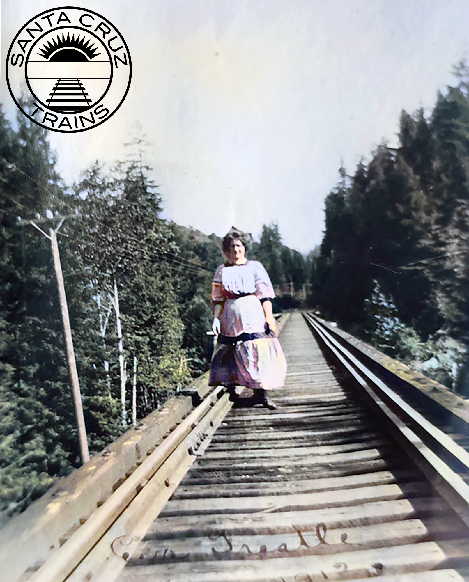
Woman on the Hooker Creek bridge north of Eva, 1912. [Ginger Constantine Navarrete – colorized using DeOldify]

Southern Pacific clearly had less interest in maintaining a remote maintenance yard, but it was looking for potential picnic stops in the mountains. Although the area around Hooker Creek had been logged over in the 1860s and early 1870s, second growth redwood trees were already appearing and the large meadow where the maintenance equipment had likely sat was ideal for a picnic ground. The railroad sent out W. T. Fitzgerald, general passenger and freight agent for the narrow-gauge division, to inspect the property and make sketches of it that could be used in marketing.

Members of the local Elks Lodge vacationing at Eva Vista, ca 1910. Printed in the Los Gatos Times–Saratoga Observer, July 23, 1974.

The picturesque station opened under the name Forest Grove on April 20, 1888, with a group of Presbyterians traveling from Brooklyn, New York, as its first visitors. The railroad provided picnic tables and accessories, and the people were responsible for bringing food. Though few amenities were provided to the revelers, they loved the place, noting that the “mountains covered with redwood forests, valleys and ravines in which marvelous ferns grow and wild flowers abound, and through which gurgling brooks flow in crystal streams, give abundant scope for romping and climbing by young America.” Over subsequent years, many different groups held annual picnics at Forest Grove, including the Knights of Pythias, the Native Sons of the Golden West, and Southern Pacific itself. The popularity of the picnic stop was such that in 1889, the Oakland Tribune declared it superior to Big Trees.

View of the resort looking south, with the Southern Pacific tracks to the left of the photographer and Los Gatos Creek to the right, ca 1909. Printed in the Los Gatos Times–Saratoga Observer, July 23, 1974.

Forest Grove continued to serve Southern Pacific as its chief picnic resort in the Santa Cruz Mountains until the end of the 1895 summer season. The next spring, the company opened Sunset Park south of Wrights and all picnic traffic was redirected there. For two years, Forest Grove seems to have languished, but in 1899 it was leased to Thomas M. Silvey of Wrights, who promoted fishing, hunting, and bathing in the San Francisco Examiner. In late 1889, W. R. Sterne of Los Angeles took over the lease and purchased the adjacent estate of the late Frederick A. Marriott, editor of the San Francisco News Letter tabloid.

Eva Vista Hotel beside the artificial lake and outbuildings, ca 1910. Printed in the Los Gatos Times–Saratoga Observer, July 23, 1974.

Sterne dammed Los Gatos Creek in order to create a small lake in which people could swim. He also began improving his newly-acquired property, erecting the Eva Vista Hotel up on the hill overlooking the lake and railroad tracks. The station, meanwhile, was renamed Eva to better promote the resort. Sterne never enjoyed the property, though. In May 1903, he sold the estate and the lease to H. R. Judah, assistant general passenger agent for the Southern Pacific. Judah soon erected a tent city and club house on the picnic grounds and expanded the hotel’s restaurant to support a larger crowd.

Postcard of Lake Evavista with an inset image of the cookhouse, 1910. [WorthPoint – colorized using DeOldify]

Unfortunately for Judah, his resort was not to last. When the San Francisco earthquake struck before the start of the 1906 season, it caused a landslide that blocked Los Gatos Creek causing it to overflow and flood the railroad tracks and much of the resort grounds at Eva Vista. Railroad traffic was canceled beyond Alba until August 1907, with only repair trains passing through to fix the right-of-way and widen the Summit Tunnel at Wrights. However, the flooded resort was only cleared in December, long after the picnic season had ended. The Panic of 1907 and the widening of the tunnel between Laurel and Glenwood in 1908 made the prospect of reopening Eva Vista infeasible.

San Francisco Chronicle advertisement for Evavista Resort, printed June 2, 1909.

When it finally welcomed visitors again in 1909, the resort was under the management of Peter Charles Trobock and his brother, Barton N. Trobock, who rebranded it Evavista. The resort’s ultimate fate three years later was outside anyone’s control. On August 27, 1912, mice nibbling on matches in the hotel started a fire. The structure burned to the ground, taking several nearby buildings with it. The last recorded picnic excursion to Evavista was on October 16, 1915 by juniors and seniors from Los Gatos High School.

Storm damage to the Southern Pacific right-of-way near Eva, 1909. [Neil Vodden – colorized using DeOldify]

The resort site quickly fell into disrepair but the railroad station remained on timetables for 25 more years. When the line was standard-gauged in 1905, a long siding measuring 2,340 feet—capable of holding 28 cars—was installed along the east side of the right-of-way. It broke off from the mainline just south of the Hooker Creek bridge and paralleled the main track for most of its length, reconnecting with the mainline just beyond the border of the rectangular parcel. A short spur continued from the end of the siding to allow up to three cars to park at the station without blocking the siding. The siding was cut back in late 1909 to 1,821 feet, enough space for about 22 cars.

Flatcars parked on the siding at Eva, 1909. [Neil Vodden – colorized using DeOldify]

The long siding may not have been intended just for passenger trains. During standard-gauging, Eva was likely used as a staging ground in the off-season for work crews. This was even more likely in the three years after the earthquake, where Eva probably served as a storage site for repair equipment and building supplies, considering the land to the east of the tracks remained Southern Pacific property. Meanwhile, in 1900, a vein of copper was discovered on the eastern hillside a mile south of Eva near the railroad right-of-way.

Southern Pacific locomotive and caboose parked on the siding at Eva, 1914. [Ginger Constantine Navarrete – colorized using DeOldify]

Perhaps because of the resort, no mining was performed until 1917, when an experimental adit was dug by H. E. Casey, J. E. Casey, and G. W. Stollery of San Mateo. The partners employed fifteen men for several months, who dug two tunnels, one 300 feet long and the other 185 feet. They found high concentrations of copper, and smaller veins of chalcopyrite, azurite, malachite, gold, and silver. However, due to poor market conditions and a lack of interest by potential buyers, they decided not to pursue further mining. The mines were sold to Dr. H. C. Adair in 1929, who promptly resumed prospecting. Four adits were dug into the hillside, with the largest supported by a timber frame. Large quantities of pyrite and other sulfides were discovered. A second attempt by Adair in 1936 found a quantity of gold and silver, resulting in the only profit gained from mining operations near Eva. The two longest tunnels, 235 and 500 feet in length, were abandoned in 1938. It is unclear if these operations used Eva station, but they are likely the reason why the railroad retained the station for so many years after the closure of the resort.

A Southern Pacific commuter train stopped at Eva, July 9, 1939. Photo by Wilbur C. Whittaker. [Jim Vail]

Eva Station was approved for abandonment on August 9, 1937 due to disuse, with Southern Pacific records showing it closed on October 15 of that year. It was removed from employee timetables in May 1939. The closure of the mountain route the following February put an end to any hope of rejuvenating the area around Eva. Following the legal abandonment of the line on March 25, 1941, the property reverted to its original owners, who had several years earlier sold the property to the San Jose Water Company. At the time, nobody lived in the vicinity of Eva to contest abandonment.

Southern Pacific survey photo of the Hooker Creek bridge just to the north of Eva, March 1940. [Bruce MacGregor]

Geo-Coordinates & Access Rights:

37.153˚N, 121.960˚W

The San Jose Water Company continues to own the land, though the right-of-way through the former site of Eva is so overgrown with poison oak and Scotch broom that it is virtually impassable. As a result, the company has not blocked access to this section of the grade, though trespassing is not advised for health and safety reasons.

Citations & Credits:

  • Bender, Henry, "SP22."
  • California Division of Mines, California Journal of Mines and Geology, 50 (January 1954).
  • California Journal of Mines and Geology 50 (January 1954).
  • California Public Utilities Commission, Decision No. 30018.
  • Hamilton, Fletcher. Report XVII of the State Mineralogist (San Francisco, CA: California State Mining Bureau, 1921).
  • Interstate Commerce Commission, Vol. 242.
  • Los Gatos Mail, 1915.
  • Oakland Tribune and Evening Tribune, 1884–1890.
  • Record-Union, 1888.
  • Sacramento Bee, 1882.
  • San Francisco Call, 1905.
  • San Francisco Examiner, 1899.
  • San Jose Daily Mercury, 1903.
  • San Jose Evening News, 1912.
  • Santa Cruz Sentinel, 1885–1903.
  • Southern Pacific Railroad Company, various records.
  • Whaley, Derek R. Santa Cruz Trains: Railroads of the Santa Cruz Mountains (Santa Cruz, CA: 2015).
  • Wiley, Marlene. “Riding the Picnic Trains,” Mountain Network News (date unknown).
  • Young, John V. Ghost Towns of the Santa Cruz Mountains, expanded edition (Santa Cruz, CA: Western Tanager Press, 1984).

Friday, September 25, 2020

Railroads: Love Creek Railroad

Logging activity in the Santa Cruz Mountains was on the rise in the 1880s. Redwood mills from south of Felton to north of Boulder Creek and along many of the San Lorenzo River's feeder creeks rapidly expanded following the construction of the San Lorenzo Valley Flume & Transportation Company's v-flume that ran down the valley. It alongside its subsidiary Santa Cruz & Felton Railroad brought millions of board feet of lumber to market via the Railroad and Powder Works Wharves at the Santa Cruz Main Beach. James Pieronett Pierce, a Santa Clara entrepreneur and speculator, wanted in on the local action and approached the task from several angles. Already the founder and president of the Bank of Santa Clara, Pierce used his wealth to embed himself within Santa Cruz County community and industries. He purchased the Pacific Avenue Street Railroad line in 1877 as well as the Santa Cruz Opera House. He became a director in both the railroad and flume projects. But more importantly to Santa Cruz history, he bought the land of Harry Love midway between Felton and Boulder Creek in order to harvest thousands of acres of redwood timber.

A waterfall below a narrow wooden bridge on Love Creek, c. 1900.
[Santa Cruz Public Libraries – colorized using DeOldify]
Captain Harry Love, 1860s.
[Santa Cruz Public Libraries –
colorized using DeOldify]
The California Ranger Harry Love was famous for having tracked down and killed the outlaw Joaquín Murrieta Carrillo on July 25, 1853. In the late 1850s and 1860s, Love lived on a ranch three miles north of Felton along a creek later named after him. At some point in the mid-1860s, Love fell on hard times and sold portions of his ranch to several individuals, including a Captain Staple, who grew Christmas trees on a section and otherwise worked for George Treat's sawmill south of Felton, and Charley Brown, who ran a mid-sized lumber mill somewhere along Love Creek. James Pierce bought Staple's property around 1876. The original tract encompassed the entire west bank of the Love Creek basin, which at the time was estimated to contain between thirty and fifty million board feet of redwood timber. Across from the confluence of Love Creek and the San Lorenzo River, Pierce built his baronial summer residence on a slight rise from where he could view the entire surrounding valley. This property would later evolve into Hotel Rowardennan in the 1890s, but in the meantime, Pierce grew hay for the livestock used in his logging operations.

In 1877, Pierce bought the Enterprise Mill on Love Creek from John Mill, presumably a relative of Harry's. Two years later, he incorporated the Pacific Manufacturing Company. By 1881, he had bought out a former business partner, H. W. McKoy, and took control of his mill as well and shipped this new machinery up the San Lorenzo River. At the confluence of Love Creek and the river, he erected a mid-sized lumber mill, which grew quickly as Pierce added more machinery and expanded the size of the affiliated settlement, initially known as Pacific Mills. During the next few years, he joined many other lumber firms in using the flume that passed through the village to transport lumber to market. When the Felton & Pescadero Railroad snaked through the area in mid-1884 to replace the flume, Pierce jumped at the opportunity to expand his reach up Marshall and Love Creeks, areas which had only lightly been harvested thus far.

County survey map showing parcels for sale in Ben Lomond with all of the Southern Pacific and Pacific Manufacturing Company's trackage in town, September 1887. [Santa Cruz County Records]
From the time that the new railroad passed through his mill town, Pierce planned to install private narrow-gauge railroad tracks to his timber tracts. Other local lumber firms had already done so including the Santa Clara Mill & Lumber Company, the Union Mill, and the F. A. Hihn Company, so its feasibility had already been proven. A September 1887 survey of the town of Ben Lomond shows tracks heading up Hubbard Gulch (then called Paterson Gulch) to the west, another track across the San Lorenzo River beside the vehicular bridge to the south, and a third track up Love Creek to the north, in addition to the mainline track and many spurs that ran through the village. The route up Hubbard Gulch crossed the San Lorenzo River to the west in roughly the same location as the Highway 9 bridge today. It then turned up Hubbard Gulch Road and continued for an unknown length. Pierce hoped that it would eventually run for three miles until reaching the logging community at Pine Flat at the top of Ben Lomond, but this never appears to have happened and the track probably did not extend more than a quarter mile up modern-day Hubbard Gulch Road. The southern track was certainly the shortest and probably catered to Pierce's personal residence just across the river.

The Pacific Manufacturing Company planing mill in Santa Clara, 1898.
[Alice Iola Hare Collection, Santa Clara City Library – colorized using DeOldify]
The third and longest track was installed along Love Creek and this route is much better documented both on maps and in newspapers. From the available evidence, it was in operation from December 1887 until at least 1893. The line's only known track joined the mill company's internal mainline near the junction of Fillmore Avenue and Mill Street in Ben Lomond and then proceeded north, crossing the Southern Pacific Railroad's Felton Branch east of Main Street and continuing until merging with modern-day Love Creek Road at Central Avenue. Beyond Sunnyside Avenue, the crudely-built narrow-gauge railroad entered the redwood wilderness of the Love Creek basin. From this point, there is a good description of the route given in the Surf in 1889:
The cream of the day's enjoyment was a trip on this pocket edition of a railway up the picturesque Love creek canyon to the logging camp. Seated in comfortable chairs upon the flat car, steaming along through the mild spring air, stopping to pick up a few ferns, or remove a fallen branch from the track, crossing Love creek thirteen times in a mile and a half and watching the mountains as they rose height beyond height, this was certainly an ideal way of penetrating the everlasting hills. The "man at the wheel," like the mate of the Nancy Bell, was captain and crew and all, and evidently made a pet of his tiny engine.

A glimpse into the canyon where the great body of timber begins enables one to feebly realize the vastness of Mr. Pierce's four thousand acre tract of timber, which extends nearly to the town of Boulder, and which will be tributary to the mill at Ben Lomond.

The train mentioned in this description was a small locomotive and six flatcars that Pierce purchased in early 1888 for use on his private lines. No photographs of the rolling stock have been found and even the style of the locomotive is unknown.

County survey map of Love Creek properties and the Love Creek Railroad, c 1887.
[Santa Cruz County Records]
The actual length of Pierce's trackage in the area of Ben Lomond is inconsistently reported by newspapers of the time. The article above implies that the Love Creek track was at least a mile and a half and the article elsewhere states that Pierce owned a total of 2.5 miles of trackage in the area. The figures for the tracks in town amount to just short of one mile of additional track, so that may be the maximum extent for the rest of the area. However, logging companies often installed and uninstalled track as needed and it is possible that as much as seven miles of track ran up Love Creek at one point, and more frequently three miles is given for the length of this route. The latter seems more likely since the Love Creek basin in total is only four miles in length. The evidence for where precisely the route went beyond Smith Creek is unclear, although it did continue further along Love Creek for at least a short distance. The logging camp mentioned by the reporter was almost certainly at the confluence of Love and Fritch Creeks, which was the last flat area before continuing up increasingly steep grades.

A waterfall on Love Creek, c 1900. [Santa Cruz Public Libraries]
When precisely the Love Creek Railroad shut down is unknown. Partners Duffey and Simmons began running a mill two miles up Love Creek in October 1890, however, and continued to run the mill on behalf of Pierce until it was destroyed in a boiler explosion in May 1891. Duffey alone rebuilt and shut down for the season in December. It seems likely that this mill continued to use the Love Creek Railroad to get its lumber to Ben Lomond since a December 1892 newspaper report stated that the old locomotive had jumped the track at the southernmost crossing over Love Creek, spilling its lumber into the creek bed. This means that the railroad was still in operation a year later. Following the derailment, horses were used to haul the machinery back onto the grade and the railroad resumed service. 

There are no further mentions of the railroad after December 1892 and it likely was removed before or after the summer 1893 season. By this point, Pierce had incorporated the Ben Lomond Land & Lumber Company in order to consolidate his twin goals of selling his property to interested developers and cutting his remaining timber. The mill in Ben Lomond was also gone and most of the trackage in the town had been consolidated. Whether Pierce even owned the Love Creek Railroad route by 1893 is unclear, but it certainly did not last much beyond that time. In May 1893, the Bank of Santa Clara failed, leaving Pierce short on funds. It was likely this that led to the dissolution of his company and the sale of the remaining land he owned in the region, the remainder of which were sold following his death in 1897. Today, traces of the railroad are occasionally found on the west bank of Love Creek near Smith and Fritch Creeks, where significant bridges were once located. But nothing much remains and that which does is found by chance, usually on private property.

Citations & Credits:
  • Hamman, Rick. California Central Coast Railways. Second edition. Santa Cruz, CA: Otter B Books, 2007.
  • Pepper, George. Personal correspondence.
  • Santa Cruz Sentinel, 1885–1892.
  • Santa Cruz Surf, 1885–1892.
  • Whaley, Derek R. Santa Cruz Trains: Railroads of the Santa Cruz Mountains. Second edition. Santa Cruz, CA: Zayante Publishing, forthcoming.

Friday, September 11, 2020

Maps: Downtown Santa Cruz

The 1.9 miles of trackage between the eastern portal of the Mission Hill tunnel and the bridge over the San Lorenzo River saw much change of the decades. The first track through this area was probably set in early 1875 by the Santa Cruz & Felton Railroad and since that time the section has undergone five distinct phases in development, each demonstrating its own unique characteristics.

A Southern Pacific excursion train on Chestnut Street with the remnants of the second track recently paved over at left, c 1950s. Photography by L. L. Bonney. [Jim Vail – Colorized using DeOldify]
The first phase was the brief period from 1876 to 1883 when the city hosted two narrow-gauge railroads and all of its horsecar lines were owned by or derived from those two lines. The Santa Cruz & Felton Railroad maintained a track initially down Pacific Avenue and, following the completion of its tunnel under Mission Hill in 1876, later down Chestnut Street. Its former Pacific Avenue track was subsequently spun-off as the Pacific Avenue Street Railroad, a horsecar line that ran up Mission Street on one side and ultimately to the San Lorenzo River at the beach on the other. The Santa Cruz & Felton was also responsible for building the Railroad Wharf—it's southern terminus—and a connection to the adjacent Powder Works Wharf, which was soon afterwards demolished in 1882. The railroad supported a small selection of customers north of Beach Hill including the Centennial Flour Mills and Olive & Foster, but otherwise was mostly focused on delivering lumber and lime products from Felton. When the South Pacific Coast Railroad took over the line in 1880, it added a new passenger depot outside the portal of the tunnel and expanded the freight yard beside Neary Lagoon to add more sidings for Grover & Company and later lumber customers. Little else changed for the company until 1893.

A short South Pacific Coast Railway train outside the Santa Cruz Union Depot, late 1890s.
[Harold van Gorder Collection, Santa Cruz Museum of Art & History – Colorized using DeOldify]
The division between the first two phases was really more represented by the other railroad in town, the Santa Cruz Railroad. Completed in 1876, the system began as a narrow-gauge route and operated its own City Railroad horsecar line using its existing trackage between Cherry Street and the bathhouses at the beach. It likely had at least one crossover with the Santa Cruz & Felton near Cherry Street, where the two tracks began their parallel route down Chestnut Street, but there appears to have been little cooperation between the two lines. Focused more on customers further to the east, the Santa Cruz Railroad had no freight customers in the Lower Plaza of Santa Cruz. Fiscal and natural disasters in 1881 led to the railroad's sale to Southern Pacific, which promptly ended the City Railroad and standard-gauged the route to Watsonville.

Map showing Santa Cruz city trackage, including horsecar lines, c 1892. [Derek R. Whaley]
This prompted the second phase, which lasted 1883 until 1892, where rival gauge track crisscrossed downtown. The South Pacific Coast, which was leased to Southern Pacific in 1887, maintained a narrow-gauge alongside the Pacific Avenue Street Railroad, the East Santa Cruz Horse Railroad, and the Santa Cruz, Garfield Park & Capitola Railroad, while the Santa Cruz Branch of the Southern Pacific had a standard gauge. Two separate passenger depots for the railroads faced each other across Cherry Street and rolling stock could not properly interchange between the tracks, leading to transfers of cargo and the Railroad Wharf becoming dual-gauge. Meanwhile, no standard-gauge traffic could go north of Mission Hill while no narrow-gauge traffic could head east.

The Santa Cruz Union Depot after the tracks were standardized, 1910s.
[M. Jongeneel Collection, Santa Cruz MAH – Colorized using DeOldify]
The opening of the Santa Cruz Union Depot in 1893 inaugurated the third and least known phase. Most of the trackage between the Mission Hill tunnel and the Railroad Wharf were dual-gauged and the old depots opposite Cherry Street both closed and were replaced with a new combined depot at the end of Washington Street beside the old Santa Cruz & Felton freight yard. A few new freight customers moved in including the Santa Cruz Lumber Company, formed from a merger of several other companies, the Loma Prieta Lumber Company, and the Union Ice Company. Meanwhile, the trackage was simplified somewhat with the main track migrating from the Beach Hill cut to the Neary Lagoon outlet.

Excursion train on the Davenport leg of the wye at Santa Cruz, July 21, 1951. Photograph by Wilbur C. Whittaker.
[Jim Vail – Colorized using DeOldify]
During this time, standard-gauge tracks to Davenport via both the Coast Line Railroad—a Southern Pacific subsidiary—and the Ocean Shore Railroad led to the expansion of the maintenance and turning yard to facilitate the addition of a wye and switchback from the Lower Plaza to the marine terrace to the west. A spur was also added at the beach for the Cowell Lime & Cement Company, ostensibly to serve the company but obviously to block the Ocean Shore's ability to build a pier into the Monterey Bay.

Map showing Santa Cruz city trackage, including streetcar lines, c 1920. [Derek R. Whaley]
When the route reopened in 1909, all of the trackage in Santa Cruz was standard gauge and the entire freight yard around the Union Depot was reorganized, prompting the fourth and longest phase of trackage within the city. From 1904 to 1926, the Union Traction Company held a monopoly on the local streetcar services, standard-gauging, simplifying, and electrifying all of its lines. When the company finally replaced its streetcars with buses, it pulled all of its municipal trackage. Meanwhile, from 1909 to 2003, the layout of the freight yard only changed a little, despite many customers coming and going over the decades and the depot itself closing in 1973.

A double-headed excursion train on Chestnut Street with the remnants of the second track recently paved over at left, April 25, 1948. Photograph by Wilbur C. Whittaker. [Jim Vail – Colorized using DeOldify]
A few substantial changes occurred, though, including the closure of the Ocean Shore Railway in 1920 followed by its track abandonment three years later, the removal of tracks from the Municipal Wharf in 1931, and the demolition of the turntable and engine house in 1942. The end of scheduled passenger service to Watsonville in 1938 and to San José in 1940, followed later by the end of the Suntan Special in 1959 and all special excursion trains in 1965, also marked an important turning point for the city. Slowly, structures began to disappear, largely due to fire, but the tracks remained down Chestnut Street, there was still siding space for sand hoppers at the depot, and the iconic wye is a fixture even today.

An excursion train turning onto Beach Street, June 25, 1939. Photograph by Wilbur C. Whittaker.
[Jim Vail – Colorized using DeOldify]
The fifth phase of Santa Cruz trackage history began approximately in 1985 when the Santa Cruz Big Trees and Pacific Railway began running tourists between Felton and the Santa Cruz Beach Boardwalk. By this point, only a few freight customers remained at the Santa Cruz yard and most other than the Santa Cruz Portland Cement Company only used the trackage sporadically. A more formal start to this final period came in 2003, seven years after Union Pacific took over the line, when the municipal trackage was completely removed with the exception of the three main tracks to Davenport, Felton, and Watsonville and a single short spur. Freight and the Big Trees train continued to pass through the area but no longer stopped there for any reason except allowing trains to pass.

The Routes Today:
The primary arteries of the routes through the city still exist and can largely be followed legally. The track begins near the junction of Chestnut Street and Green Street just west of downtown and continues down Chestnut Street for nearly a mile. Along the way, a few century-old wigwags still can be found and they continue to operate when a train runs down the street. The dual tracks down Chestnut Street have long since been removed and replaced with a single track down the middle. After crossing Laurel Street to the south, the old freight yard area is entered and can be followed along either of its branches.

A view down Chestnut Street today, 2020. [Google Streetview]
Nothing substantial remains except the spur and three ends of the wye, although a few foundation blocks and a maintenance area still occupy the former site of the turntable. While there is no trespassing allowed within the yard, a new trail will soon open allowing people to parallel the tracks. The tracks continue under West Cliff Drive to the San Lorenzo River, and this entire area is paralleled with pedestrian footpaths. No remnant of the wharf spur remains. Similarly, the former Ocean Shore right-of-way above the marine terrace to the west has also been built up and is no longer discernible nor should exploration in this area be attempted. All evidence of the former Union Traction Company trackage has long since disappeared.

Citations & Credits: